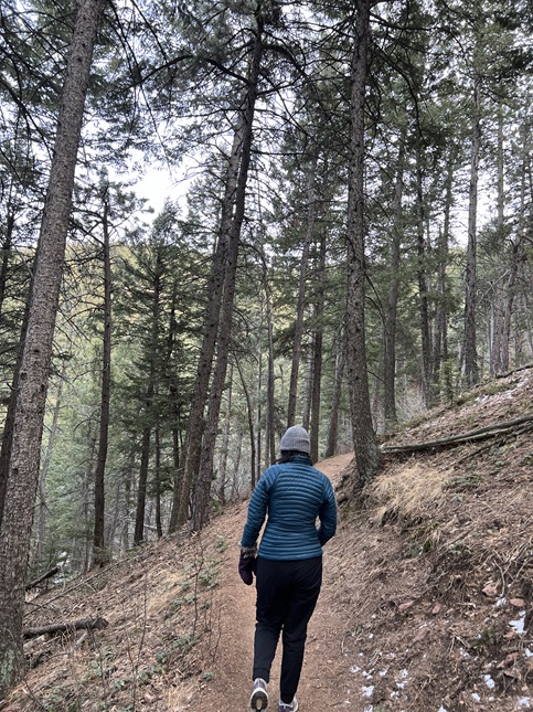
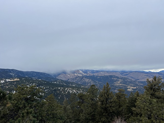
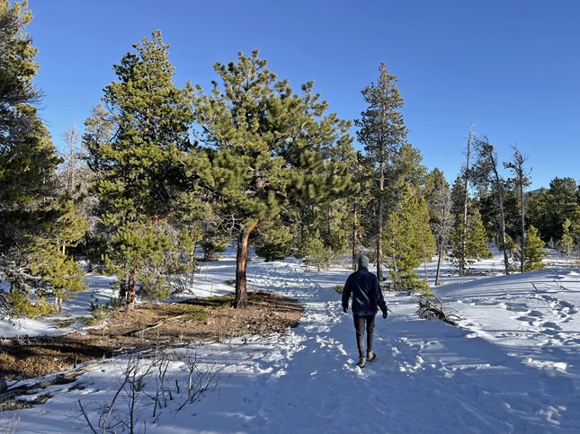
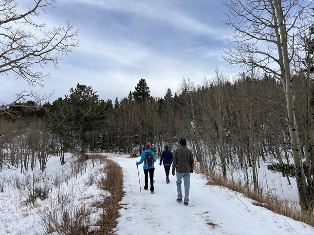
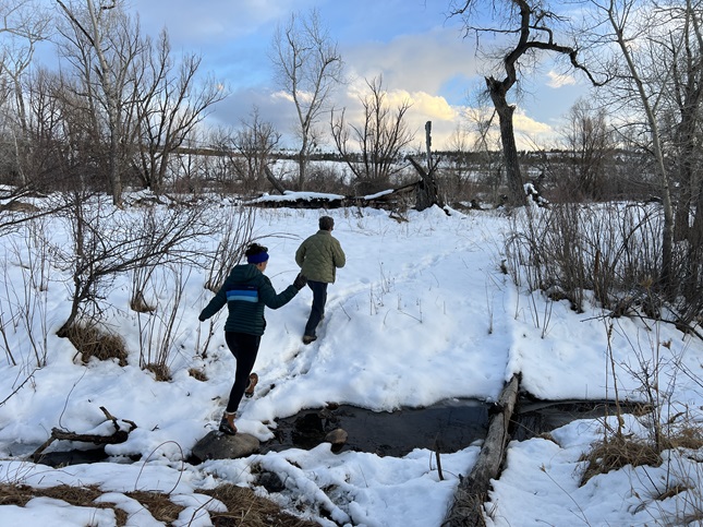
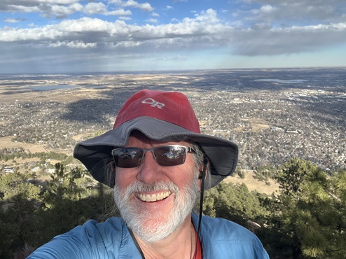
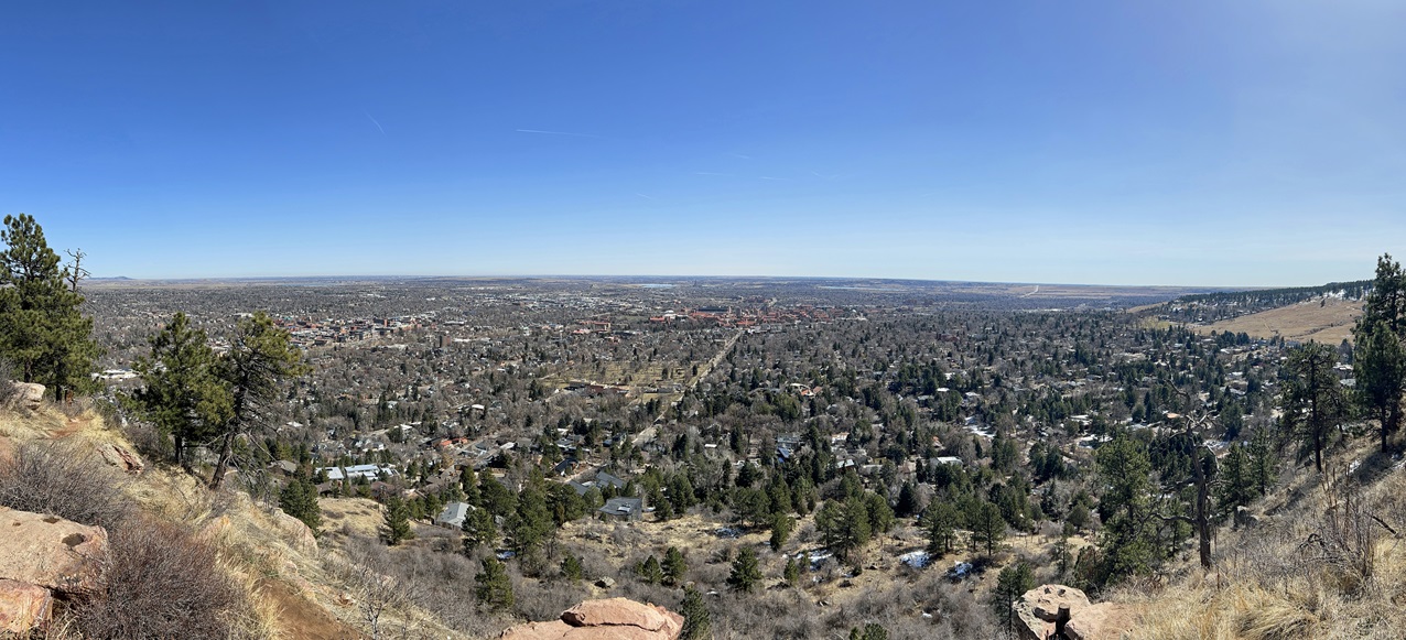
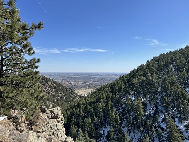
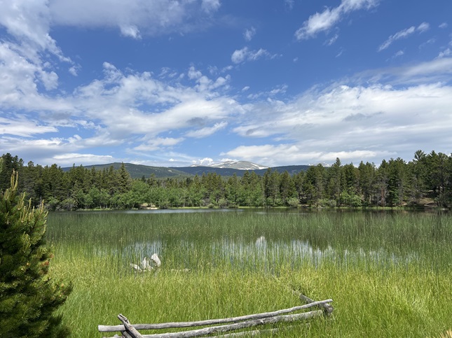
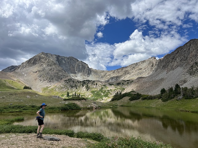
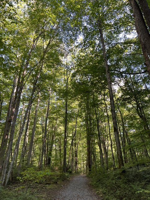
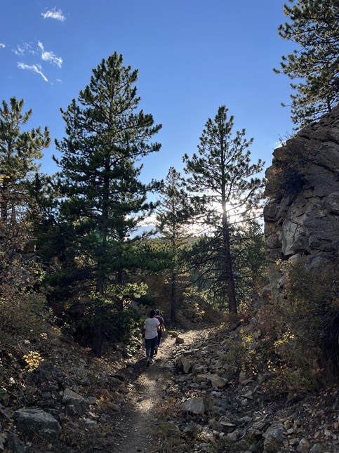
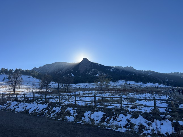
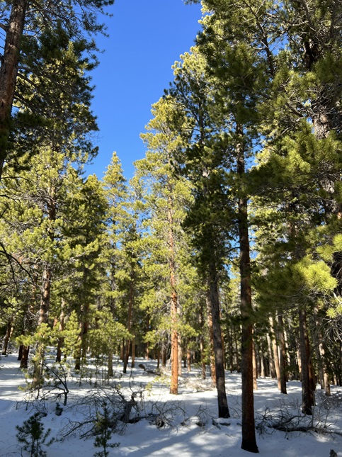
1) Green Mountain, Boulder County Open Space & Mountain Parks, Boulder, CO, January 7, 2024 - No sooner than we have closed out 2023 and it was time to get the first hike of 2024 in the books. Jonna was busy but Desiree, Gaelin and Alan got together on Sunday afternoon to hike the loop at the top of Green Mountain. We met up at the top of Flagstaff mountain and took Ranger trail to where the EM Greenman trail branches off to the east. We took that all the way to the top. It was cold and very icy in spots but we were able to get to the top without requiring microspikes for our boots. After a brief (and chilly!) stop at the top we headed down the West Ridge trail to where it meets with the top of Ranger. We then took Ranger all the way back to the trailhead. Ranger, being on the north side of Green Mountain, was much icier so I used the extra traction for the hike back down to the trailhead. The temperature was in the mid-20s but thankfully there wasn't any wind so the hiking allowed us to generate enough body heat to stay warm. However, low-lying clouds covered the Continental Divide to the west so we missed out on the grand panorama of snow covered mountains usually visible from the top. Nonetheless, it was a good hike to start off in the New Year. A 4 mile loop with 1,500 feet of elevation gain.

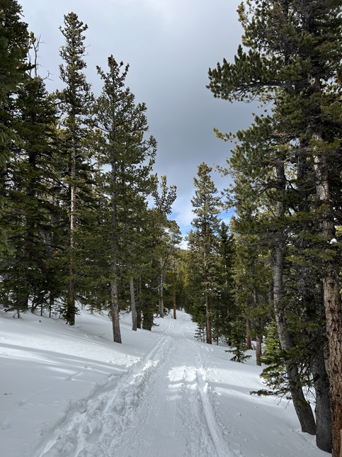
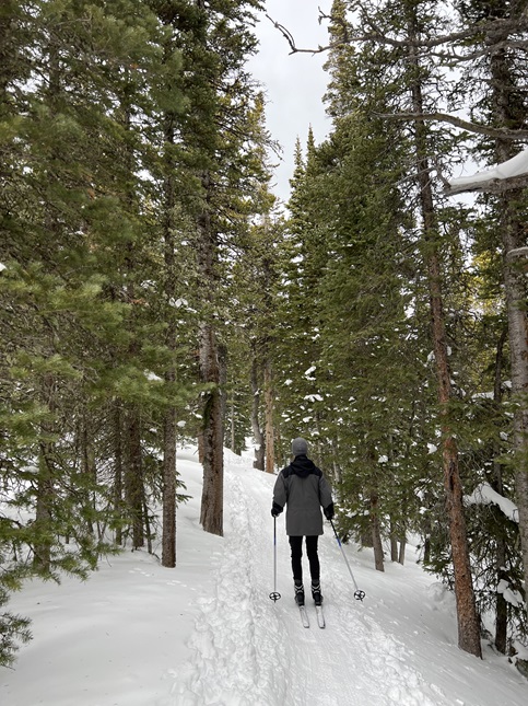
2) Sourdough Trail, Brainard Gateway Trailhead, Brainard Lake Recreation Area, Ward, CO, January 22, 2024 - Jonna and Alan decided to take advantage of last week's big snow storm to dust off our cross-country skies. We headed to Brainard Lake Recreation Area hoping that going up in elevation would mean better snow. Unfortunately, the trail was packed down into a groove. This wasn't a problem for a good skier like Jonna but was a big challenge for a bad skier like Alan. We ended up turning back early because Alan was finding the narrow groove problematic for controlling his speed. Nonetheless, even despite snow conditions, it was nice to be out in the silent and snow-covered trees. A 2.3 mile out-and-back with 200 feet of elevation gain.
3) Mud Lake, Boulder County Parks & Open Space, Nederland, CO, January 27, 2024 - This was just a quick (and short) hike to stretch our legs after a week of relative in-activity. We drove over to nearby Mud Lake and hiked the "long" loop (combining both the Tungsten Loop and the Kinnickinnick Loop). The snow had turned into packed ice so we had to wear micro-spikes on our boots but the weather was nice, the skies were blue and the trail wasn't too crowded. A 2.3 mile loop with 400 feet of elevation gain.
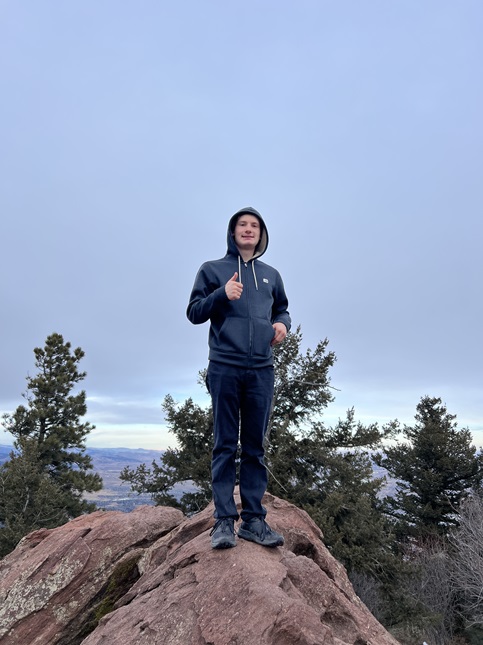
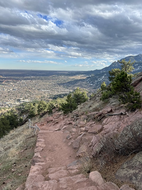
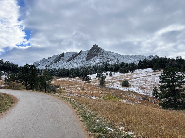
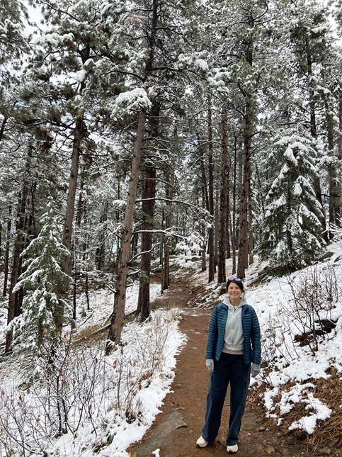
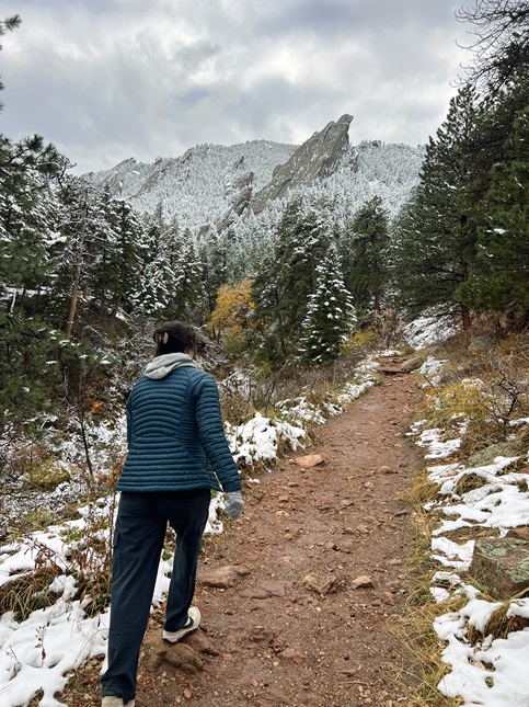
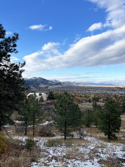
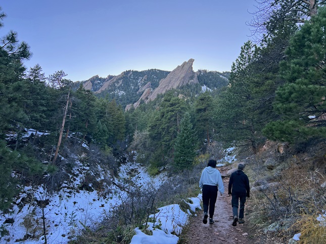
4) Mt. Sanitas, Boulder City Open Space & Mountain Parks, Boulder, CO, January 28, 2024 - Jonna was busy but Gaelin and Alan kept up the Sunday hiking tradition. We met up at the Mt. Sanitas trailhead and made the climb up Sanitas. We went up via Dakota Ridge and then started the climb up the east face. The trail was pretty tricky - very muddy at the bottom and very icy at the top. Nonetheless, the views from the top made the effort worthwhile. We then decended via the south ridge which was in pretty good shape thanks to the southern exposure to the winter sun. It was a nice hike and a great chance for Gaelin and Alan to geek out for a couple of hours straight. A 3.6 mile loop with 1,200 feet of elevation gain.
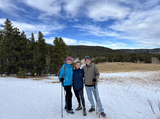
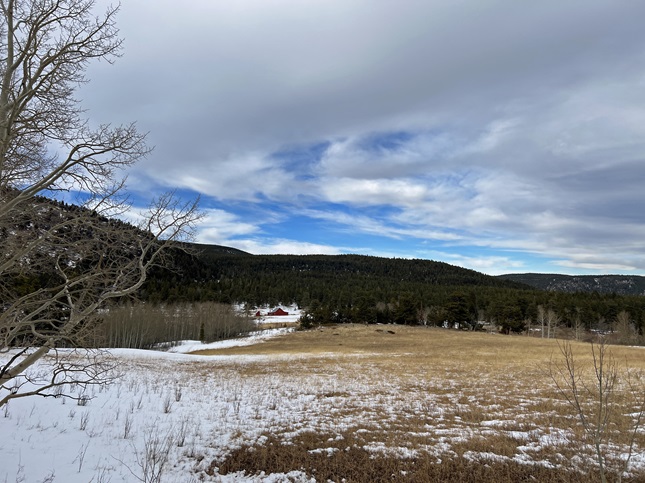
5) Caribou Ranch Open Space, Boulder County Open Space Parks, Nederland, CO, January 31, 2024 - Friends Kristin and Steve made the drive up into the mountains for a social visit and after catching up we headed over to Caribou Ranch Open Space to get in some exercise. The trail was mostly packed snow but micro-spikes and hiking poles made it an easy hike. We had blue sky to the east and clouds to the west with our trail right on the dividing line. When a breeze would pick up, the temperature seemed to drop about 10 degrees so we were thankful every time some sunshine peeked through. A relaxed hike we were happy to share with our long time friends. A 2.5 mile hike with 100 feet of elevation gain.
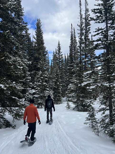
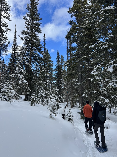
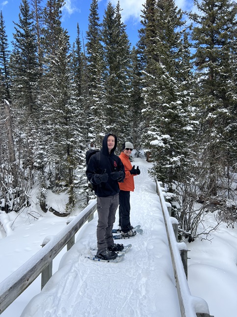
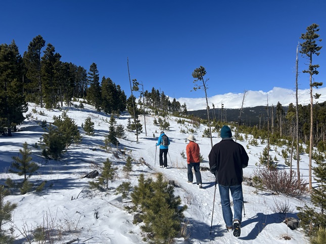
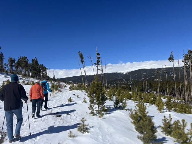
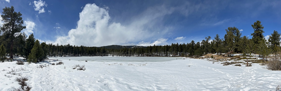
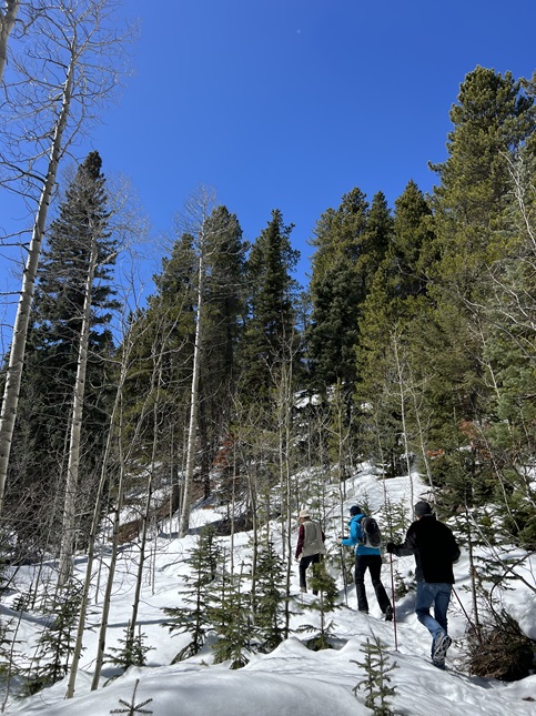
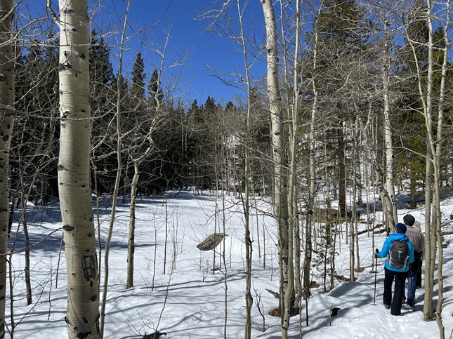
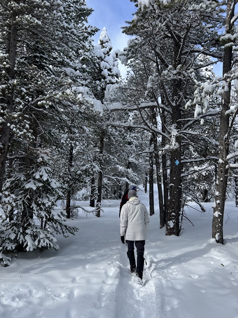
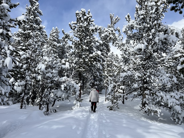
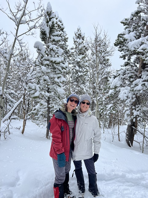
6) Sourdough Trail, Brainard Gateway Trailhead, Brainard Lake Recreation Area, Ward, CO, February 5, 2024 - We finally got some fresh snow so we invited Gaelin to join us for a snow shoe up at Brainard Lake Recreation Area. We parked in the Gateway Trailhead lot and then headed north on the Sourdough trail (#835). The trail dropped down into South St. Vrain Creek valley where the combination of recent snow, a northfacing trail and cold temperatures meant we had snow everwhere! It was a little winter wonderland. Because we got a late start we opted not to do one of the longer loops in the park but we did made a short out-and-back on the South St. Vrain Trail (#909) before climbing back up Sourdough to return to the parking lot. Gaelin will be moving away soon so we particularly treasured getting to spend an afternoon hearing all about his new job. We'll miss hiking with him on Sundays this Spring/Summer! A 3 mile out-and-back with 550 feet of elevation gain.
7) South Boulder Creek West Trail, Boulder Open Space & Mountain Parks, Boulder, CO, February 8, 2024 - Jonna and Alan drove down to Boulder where we met up our almost-family member Julia at her new place. She thought there was a way to hike directly from her front door into the Boulder Open Space & Mountain Parks area in South Boulder so we decided to go look for it. Fortunately, the fresh snow from a recent storm meant we could look for footprints and this allowed us to find a little path that eventually connected up with the South Boulder Creek West Trail. We hiked that west almost all the way to Mesa Trail but the setting sun (and rapidly dropping temperatures) turned us back before we connected into the Mesa trail system near South Mesa trailhead. We have plenty of time to catch up on Julia's new job and to enjoy the expansive views on the plains along the edge of the foothills. A 3.4 mile out-and-back with a mellow 200 feet of elevation gain.

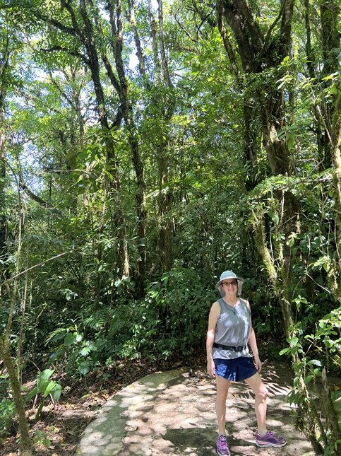
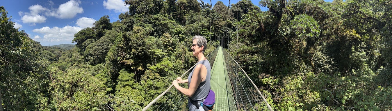
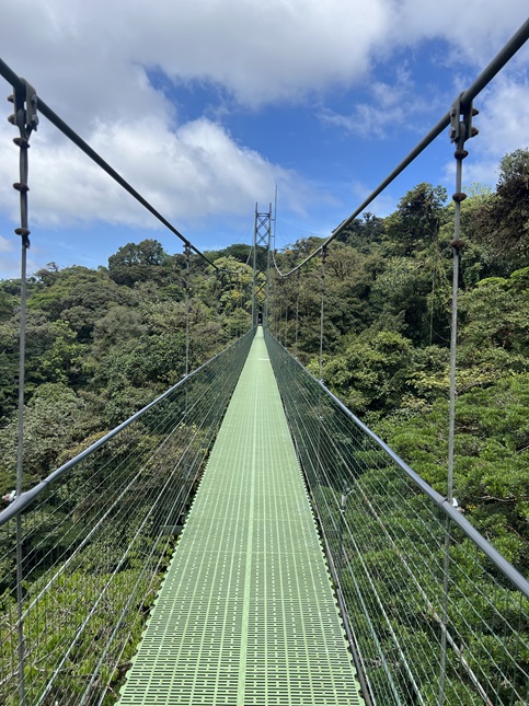
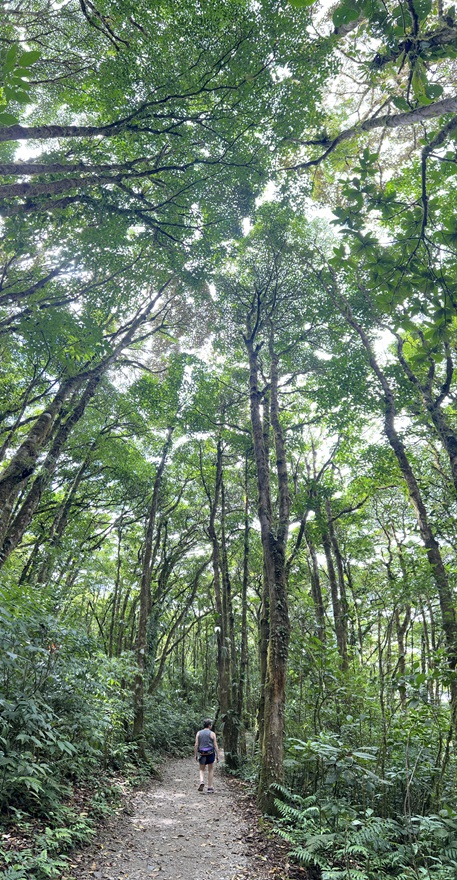
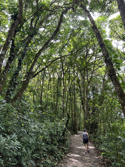
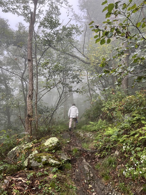
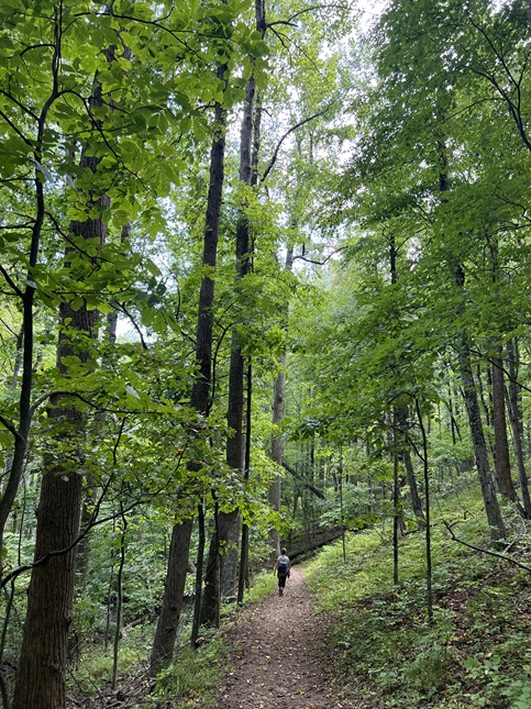
8) SkyWalk Trail, Treetopia, Santa Elena, Costa Rica, February 12, 2024 - The day after we arrived in Costa Rica for a short mid-winter escape we drove to the Monteverde Cloud Forest area near the village of Santa Elena and where we visited Treetopia. There we did their 3km loop that contains 6 aerial walkways that go through the canopy of the cloud forest 165 feet above the ground. We had beautiful sunny weather, which in this case was a negative because every creature in a cloud forest hides when the sun is out. Nonetheless, the forest was amazing to see. Layer upon layer of tree tops each one covered with creeping vines, parasitic plants, mosses, lichens and probably many more layers of living matter. We could see all the way out to the Pacific Ocean to the west and all the way to the volcanoes in the east. We also hiked trails down at the bottom of the trees as well so we got to look up through a kaleidoscope of green leaves filtering spears of sunlight. Gorgeous! A short 1.7 mile loop with 400 feet of elevation gain.
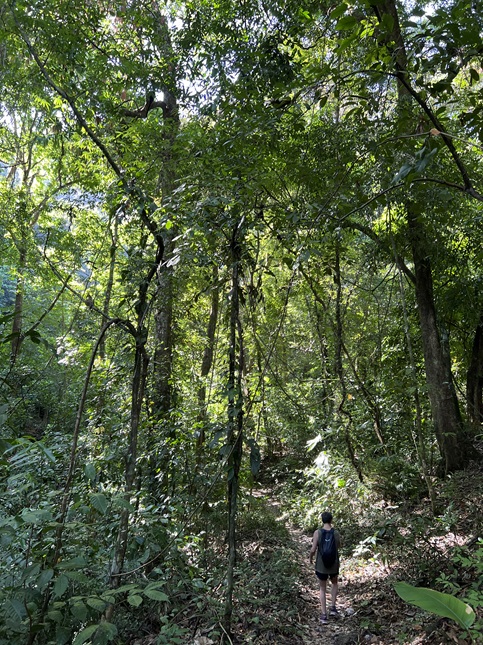
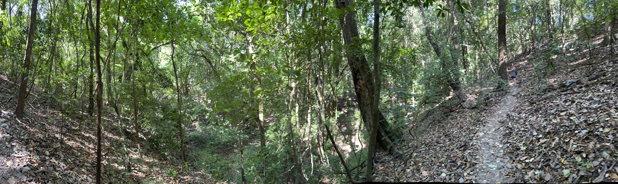
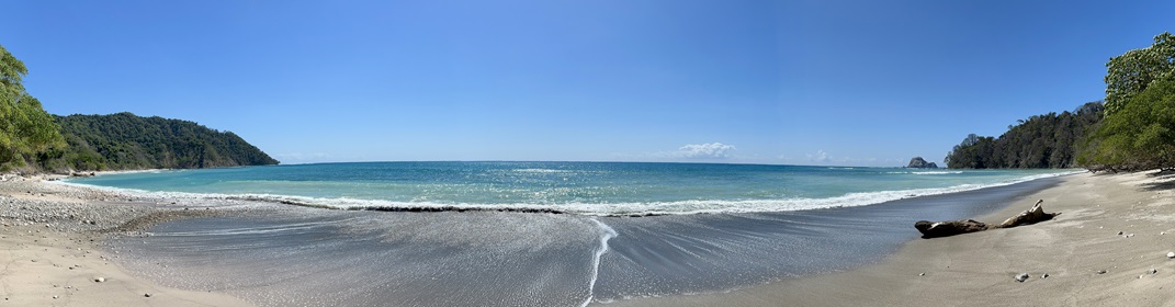
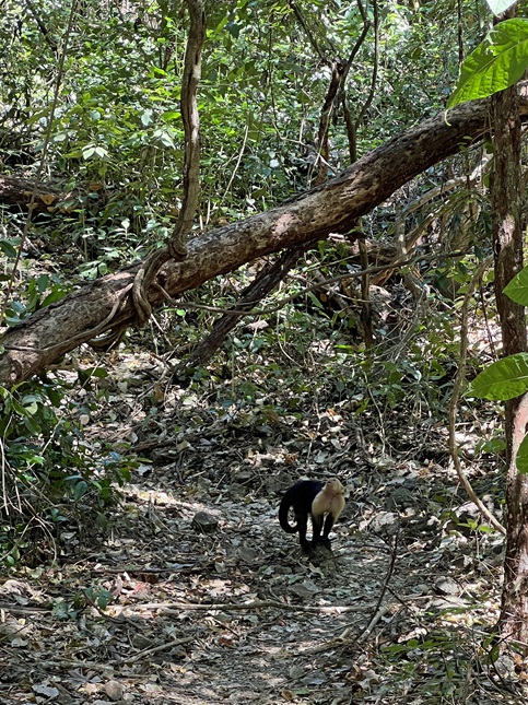
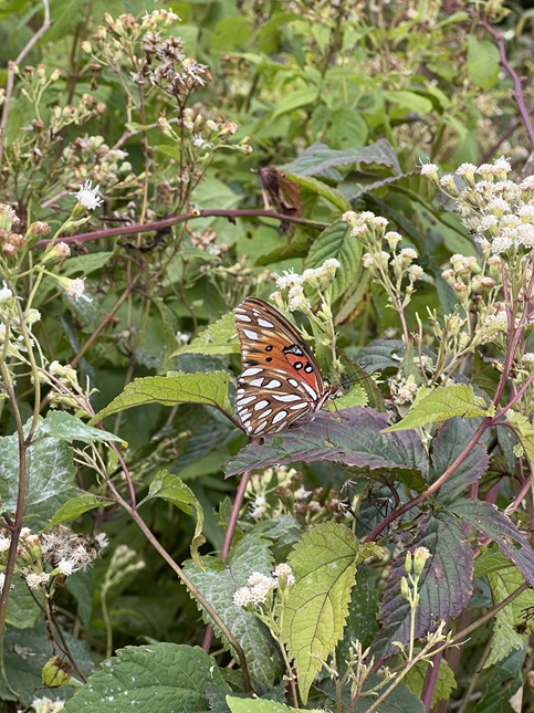
9) Senderos Sueco, Reserva Natural Absoluta Cabo Blanco, Cabuya, Costa Rica, February 17, 2024 - There was no way we were going to come to the rainforest and not get out for a hike so on our second day at the beach Jonna and Alan got up early, lined up for breakfast at our lodge before they had opened and were on the road shortly thereafter. We made the short drive to Cabo Blanco Absolute Nature Reserve - the first protected area in Costa Rica - to hike the Sendaros Sueco trail out to Playa Cabo Blanco. This trail goes up and over a series of ridges through thick jungle and then ends at a pristine beach. We don’t often do hikes with the combination of wow factor and cool refreshing break at the destination. The rainforest was beautiful. It was hot and humid and muggy but so incredibly lush. There was green on top of more green. There was an amazing variety of trees, vines and bushes. On the way in we saw two deer and a family of coatis, along with a few birds and about a million butterflies. Once we got out to the beach Jonna went for a dip in the surf while I relaxed in a hammock under some shade trees. After we’d cooled off a bit it was time to head back. There was a long climb leaving the beach and the late morning sun was beating down on the rainforest canopy so it was getting hot hot hot! On the way back we saw another four families of coati and a troop of white-faced capuchin monkeys. We got back to the trailhead right at noon and were very fast in getting the air conditioning cranked up in the rental car! A gorgeous but challenging hike that was exactly what we’d hoped for when we saw we’d be staying so close to a rainforest reserve. A 5.5 mile out-and-back with 1,292 feet of elevation gain.
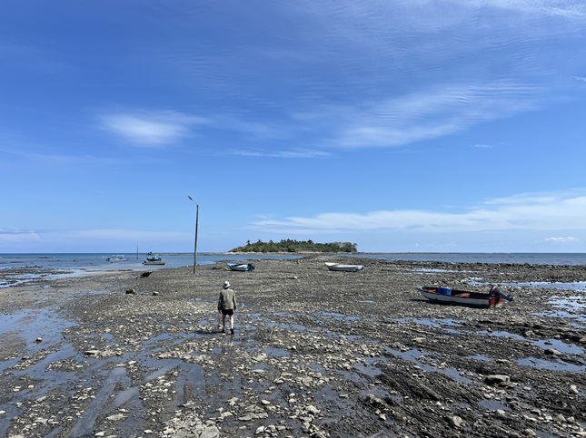
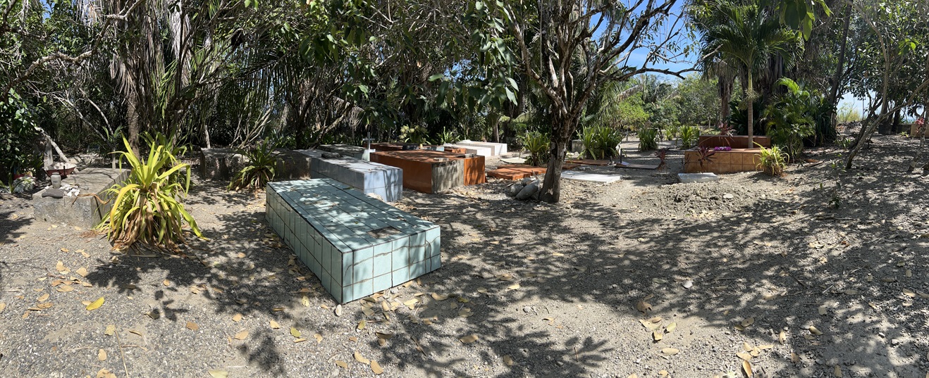
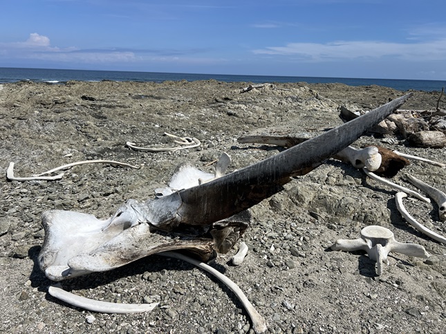
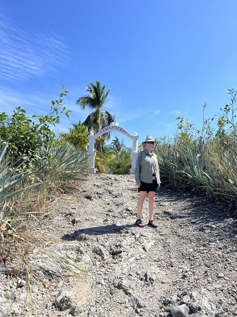
10) Cabuya Cemetery, Isla Cabuya, Cabuya, Costa Rica, February 17, 2024 - There is a small island just offshore from the village of Cabuya called Cabuya Island that has an exposed land-bridge at low tide. For a couple of hours you can walk across the seafloor to visit the island and see the tiny cemetery that is there. Low tide was at 2:30pm so we got to the small parking lot at 1:30. We paid the standard $2 to park and then made the trek over to the island. There was (as expected) no shade and the rocky sea bottom was made up of dark grey rocks so it made for *hot* walking. Add in the last pools of ocean water evaporating in the direct sun and it was also so humid you practically felt moisture seeping into your clothes from the air. The island had some trees for shade but these blocked the mild breeze so it was uncomfortably muggy. Still, the cemetery was neat to see and had a couple of covered picnic tables where we could rest. As we walked up a couple was just leaving and they said there were some whale bones on the west end of the island. Jonna and Heather were both wearing sandals for this walk and they weren’t the right shoe choice for the bare volcanic rocks that stretched off to the west. I was wearing hiking boots so I made the trip by myself. The rocks were sharp and in places covered with slimy moss where the receding water left tide-pools behind. I managed to get across without falling but it was tricky going, especially with me trying to move fast. Sure enough, on a little knoll on the very edge of the island - a spot that is probably just barely above the waterline at high tide - there was a pile of giant whale bones. All the bones small enough to carry away had been removed - either by wave action or greedy tourists - but the big chunks remained: the skull, the massive upper ribs and about half the spinal column. It was sobering but also magnificent. I took a few pictures and then speed walked my way back across the sharp, slippery seabed. I think I know what an ant would feel like if it had to walk across a frying pan. By the time I got back to the cemetery I was completely soaked and I felt like I’d spent 20 minutes in a sauna. Being in the shade dropped my core temperature about half a degree but that was enough to spur us to strike out across the land-bridge again to return to the car. At the halfway point I picked up the pace so I could get the car cranked and the A/C blasting for when Heather got to the car. We all luxuriated in the arctic air that filled the interior as we slowly drove back to the lodge. A 1.8 mile out-and-back that was basically flat with maybe 60 feet of elevation gain.
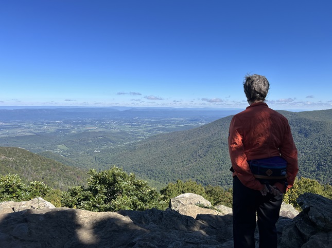
11) Divide Overlook, Chapman Drive/Tenderfoot Trails, City of Boulder Open Space and Mountain Parks, Boulder, CO, March 2, 2024 - The odds were against hiking this weekend but things came together at the last moment to get us back out on the local trails. This weekend is "Mom's weekend" at CU and our cousin Chi who is a student had invited Jonna to be her stand-in mom for the weekend since my cousin Michelle couldn't make the trip out. However, the event they'd planned to attend together fell through so Chi invited Alan to join she and Jonna for a hike instead. Alan had spent the past weekend laid flat by a cold (multiple home COVID tests came back negative) but had just enough energy to try a hike. We chose the Chapman Drive hike - the trail isn't too challenging but it still provides some beautiful panoramic views of the Continental Divide. We picked Chi up from her dorm just after lunch and drove to the Chapman Drive trailhead. From there we made the climb up to Realization Point just below the top of Flagstaff Mountain. In a few spots on the north side of the mountain there were patches of ice but temperatures in the mid-60s meant it was melting fast so we encountered everything from dry trail to slushy-mushy goop to thick ice. The gorgeous weather meant we got a nice view of the big mountains from a few different spots. More importantly, we all got to enjoy spending some time (and soaking up some vitamin D!) together. A 5.1 mile loop with 950 feet of elevation gain.
12) Mt. Sanitas, Boulder City Open Space & Mountain Parks, Boulder, CO, March 4, 2024 - Like a bad penny, the write-ups for my annual Spring Training Hikes are back once again. I am starting a little later than normal since I've been dealing with a headcold for the past week but this morning I decided I was healthy enough to give the first (of the five) peaks outside Boulder a try. Since it was a spur of the moment decision I'd be doing the hike on my own so I laced up my boots and drove down to the People's Crossing trailhead just after lunch. It was cooler than I expected but I had an extra layer so that wasn't going to stop me (though it did play hell on my still healing bronchi!) As is my traditional route I went up and over Red Rocks ridge in People's Crossing park and came down at the Centennial trailhead in Sunshine Canyon. From there I took the Dakota Ridge trail to the bottom of the east face of Mt. Sanitas. Then it was the steep climb all the way to the peak. The view there was lovely with low-lying puffy white clouds casing shadows over Boulder. I watched as they clouds floated by for a few minutes but quickly resumed the hike via the long decent on the south ridge. Trail crews have been improving some parts of this trail over the past year and the places where they've worked are much safer to hike thanks to stone steps now in places that had eroded into slick, sandy gullies. The disadvantage to starting in the afternoon was that the sun dropped behind the ridge while I was hiking down so I was chilled when I got back down to the Centennial trailhead. Fortunately, the climb back over the ridge in People's Crossing helped me generate some more body heat. It was a good hike and one I always enjoy. It was also nice to get started once again on this tradition of the Spring Training hikes...now just four more to go for this year! A 4.5 mile loop with 1,600 feet of elevation gain
13) Aspen Alley trail, West Magnolia trail system, Nederland, CO, March 6, 2024 - We had a beautiful sunny day, though a tad windy, in between snow storms so our friends Kristin and Steve drove up from Boulder and we all went for a little walk on the trails in the West Mag trailsystem. We got to enjoy the perfect blue sky and white snow-covered mountains to the northwest and also got to tromp through some fresh snow. The further west we hiked the more the wind was hitting us in the face so we made is a short hike and turned around rather than pushing on into a chilly headwind. It was a nice day out that gave us a chance to stretch our legs before another storm rolls through tomorrow. A mellow 2 mile loop with an equally mellow 200 feet of elevation gain.
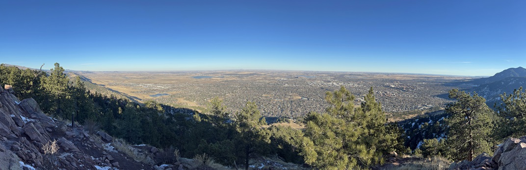
14) Flagstaff Mountain, Boulder City Open Space & Mountain Parks, Boulder, CO, March 10, 2024 - Thanks to great weather, a couple of days after the latest snow storm rolled through, I was able to check off Spring Training Hike #2 today. Jonna and Todd joined me for a morning hike up Flagstaff Mountain, starting from Eben G. Fine park in Boulder. My usual route is to climb up via Viewpoint trail to Panorama Point and then picking up the Flagstaff trail all the way up to the summit. Once up top, the Rangeview and Ute trails provide a loop before reversing the route up to descend. The trail up to Panorama Point was frozen due to sub-32 night time temperatures but a warm sun quickly pushed the air temperature up into the 60s which meant the snow-covered trail higher up the mountain was slushy as the snow and ice melted. Rangeview trail offered a beautiful panorama off to the west and Panorama Point gave an equally lovely view out over Boulder on our way back down. The trail at the bottom of the mountain that was frozen on the way up was turning into a sticky, muddy mess as we returned to the trailhead so we got back to the car with appropriately dirty boots! I think we all had a fun time swapping stories and all enjoyed the hike. A 6.5 mile up and back down trail with 1,800 feet of elevation gain.
15) Green Mountain, Boulder City Open Space & Mountain Parks, Boulder, CO, March 22, 2024 - My usual goal for the third of my five Annual Spring Training Hikes, Green Mountain, is to do it on St. Patrick's Day - thus my calling it the Hikin' 'O The Green. However, this year we had a massive spring snow storm just before that date which required we spent a week digging out our driveway and road. The result was that I did the Hikin' 'O The Green, or should I say the Hikin' 'O The White this year, almost a week late. The mountain was still covered in compressed snow and ice, from the trailhead all the way up to the summit. This meant I put on my micro-spikes in the Gregory Canyon parking lot and used them to scrap my way up the the Amphitheater, Old Saddle Rock and E.M. Greenman trails for the climb to the top. The snow was hard packed in the morning which made it uneven but with the spikes the traction was good so it was one foot in front of the other. The sun was on the south side of the mountain so I was hiking in shadow which kept the temperature cool but it also meant I was out of any breeze. Once I got to the summit I discovered there was a mild, intermittent wind which was downright cold when wearing sweaty clothes! I didn't stick around at the top long before starting down the West Ridge trail to the top of Ranger trail, then took that for my descent. By now the sun was high enough to crest the mountain which started to soften the snow. This mean post-holing and sliding as the knee-deep snow and ice turned into goo with the consistency of shaving cream. Going down was much trickier than climbing up had been. Fortunately, when I got to the top of Gregory Canyon, which is east facing, the trail was mainly mud which made that final downhill smooth. It was a challenging hike and I was happy to complete it successfully! A 5.2 mile loop with 2,500 feet of elevation gain.
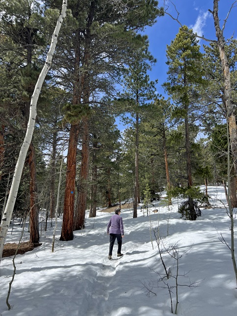
16) Mud Lake, Boulder County Parks & Open Space, Nederland, CO, March 31, 2024 - Jonna and I decided we needed to stretch our legs after a few days cooped up at home so we made an after lunch trip over to neighboring Mud Lake to hike the "long" loop there (which combines the Tungsten and Kinnickinnick Loops). This isn't really a long hike but all the snow from recent storms meant the trail was covered by about 18 inches. In most places it was packed into a narrow hard trail but stepping just an inch off that mean post-holing into knee deep wet snow. The weather was vacillating between over-cast and bright sunshine which mean the snow was slowly melting and thus was slick in places. Nonetheless, we enjoyed seeing the clean white snow shining in the sun and contrasted against a blue sky (at times). Just the leg stretch we needed! A 2.2 mile loop with 400 feet of elevation gain.
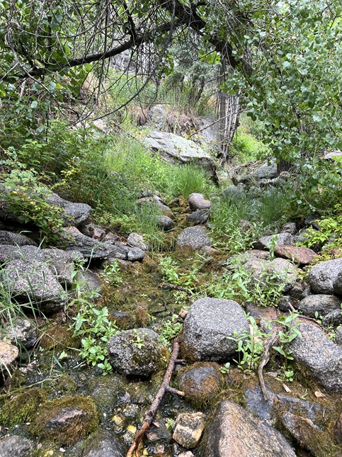
17) South St. Vrain Trail (FS# 909), Roosevelt National Forest, Ward, CO, April 3, 2024 - Our friends Kristin and Steve drove up from Boulder to enjoy the remnants of our big snow storm three weeks ago. We'd originally planned to bring them out for some snowshoeing but the warm weather we've been having during the day combined sub-freezing temperatures at night had packed down the trails up in the mountains so instead we ended up going for a short but slippery hike. We chose South St. Vrain trail and it was a nice choice. There was still enough snow to give a wintry wonderland feel to the hike while still being packed enough snow that we could hike without the snowshoes. As the sun warmed the snow-pack it started to soften up so we had a few post-hole moments and the slushy snow got our boots wet but it was still a beautiful day to be out enjoying the forested valley along South St. Vrain Creek. A 2.4 mile out-and-back with 500 feet of elevation gain.
18) West Ridge, Madrone, Starflower and Stream Trails, Redwood Bowl trailhead, Roberts Regional Recreation Area, Oakland, CA, April 25, 2024 - Jonna found a super cheap flight to San Francisco so we took advantage to make a quick trip to the Bay Area to visit with Jonna’s brother Jamie and his family. Most of our trips to Oakland include a hike in the beautiful Oakland hills and this trip was no exception. For the first day of our visit Jamie (and his new 4 month old puppy Daisy) took us up to Roberts Regional Recreation Area for a hike. We started at the Redwood Bowl trailhead next to Chabot Science Center and then made a short hop on West Ridge Trail to the top of Madrone Trail. We took that down off the Skyline Ridge almost all the way down into Redwood Creek valley but turned off onto Starflower Trail just before we reached the bottom. This southern side of the creek valley is the classic coastal Redwood landscape with gorgeous towering Redwood trees and cascading streams. We always love hiking in this area and today was perfect weather to be out among these giants. We used Starflower to drop the final leg down to the creek, then turned west onto Stream Trail which we took to the head of Redwood Creek and then started to climb back up out of the valley. This side of the valley is a completely different landscape with more shrubs, big eucalyptus trees and thick grass in open areas without tree cover. Once we made it back to the top of the ridge we re-connected with the West Ridge trail and headed back east on it. This section of trail had a wide variety of spring wildflowers already in bloom so even though this section didn’t have the marque Redwoods it still made for a lovely hike. We eventually got back to the trailhead and seeing how tired pup Daisy was we felt it was a worthy hike for all of us! A 3.8 mile loop with 700 feet of elevation gain.
19) Skyline and Round Top Loop Trails, Old Tunnel Road Staging Area, Sibley Volcanic Regional Preserve, East Bay Parks, Oakland, CA, April 28, 2024 - Jamie and Alan had Sunday free so naturally we decided to head back into the Oakland hills for a hike. I had never been to the Sibley Volcanic Regional Preserve so we headed there so I could hike a new area. To make it even more different from our usual hike we drove through the Caldecott Tunnel so we could start the hike from the east side via the Old Tunnel Road Staging Area. This put us down at the bottom of the ridge that is the remains of a 10 million year old Volcano. The Skyline Trail climbs up the lush Round Top Creek valley filled with oak and eucalyptus trees while crossing a half dozen little streams as it rises up to the Sibley Main Staging Area parking lot. From there we picked up the short Overlook Trail which we used to connect to the Round Top Loop Trail. We did the loop clockwise to get back to Sibley Main and then returned back down Skyline to where we had parked. It wasn’t a strenuous hike - I didn’t have hiking gear with me so it was just right for my jeans & T-shirt and I think it was also perfect for 5 month old Daisy who got in some leash training and plenty of interactions with strange dogs. Best of all we had beautiful hiking weather with some scenic views out over San Francisco Bay along the loop trail so definitely a nice way to spent our "free" morning! A 4.8 mile "P" loop with 800 feet of elevation gain.
20) Wildcat Gorge and Lake Anza, Tilden Regional Park, East Bay Parks, Berkeley, CA, April 30, 2024 - After being in the Bay area for nearly a week we finally had a day when all of us could get together for a hike. Jamie and Kelly (and pup Daisy!) drove Jonna and I up to Tilden Regional Park to do an easy hike there. We were going to hike near Jewel Lake but it turns out dogs aren’t allowed in that trail so we found a different trail we could hike from the same parking lot. The Wildcat Gorge trail is relatively flat so an easy walk but is quite beautiful as it is built alongside Wildcat Creek which winds through oak, bay, redwoods and eucalyptus trees. We took the trail up to Lake Anza and then made the loop around the lake on the Lake Anza Trail. Along the way we saw turtles and lizards and trout and heron and a hummingbird. There were also quite a few different varieties of wild flowers in bloom which meant bees and dragonflies and butterflies. All in all a nice day out and then we capped it off with an equally nice lunch in nearby Lafayette so two thumbs up for this outing! A 3.7 mile out-and-back with a mellow 350 feet of elevation gain.
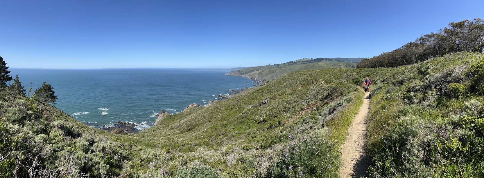
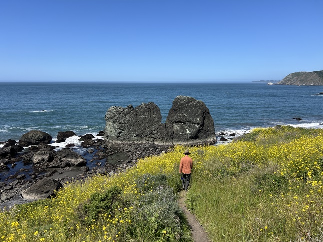
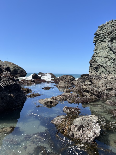
21) Owl Trail, Muir Beach Overlook trailhead, Golden Gate National Recreation Area, May 1, 2024 - For our last day in California (for this trip) we decided to squeeze in another final hike. Jamie and pup Daisy brought Jonna and I up to the Marin Headlands to hike along the spectacular Northern California coast. We chose to head to Muir Beach where we parked at the Marin Beach Overlook trailhead and hiked the short but stunning Owl Trail all the way down to Slide Ranch. Then, on our way back up, we took some side trails down to the tidepools on the edge of the Pacific. The trails were little used (we only saw one other person) and a bit over-grown. The side effect of this was that the tall grass was filled with ticks. We were stopping regularly to knock the creepy crawlies off and spent the two hours after the hike still finding them. On the plus side were the lovely wildflowers, the glorious sunshine and the amazing views of the rocky coastline. After hiking all the trails in this area we drove down to Muir Beach and spent some acclimatizing Daisy with waves and salt water. It was so cute we were all laughing and saying "Awwwww..." We finished off with lunch on the edge of San Francisco Bay. A pretty fine way to close out this trip to visit Jamie and his family. A 2.8 mile out-and-back with 600 feet of elevation gain.
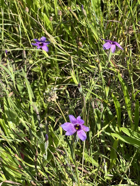
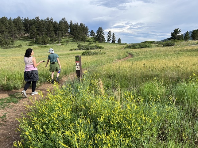
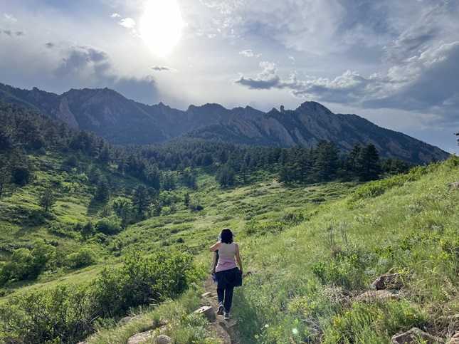
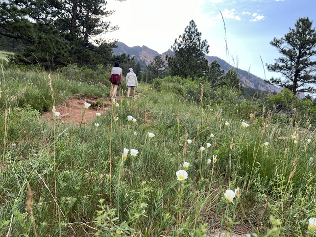
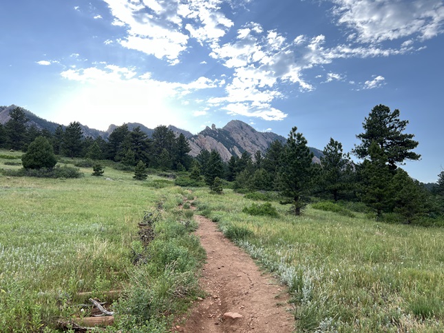
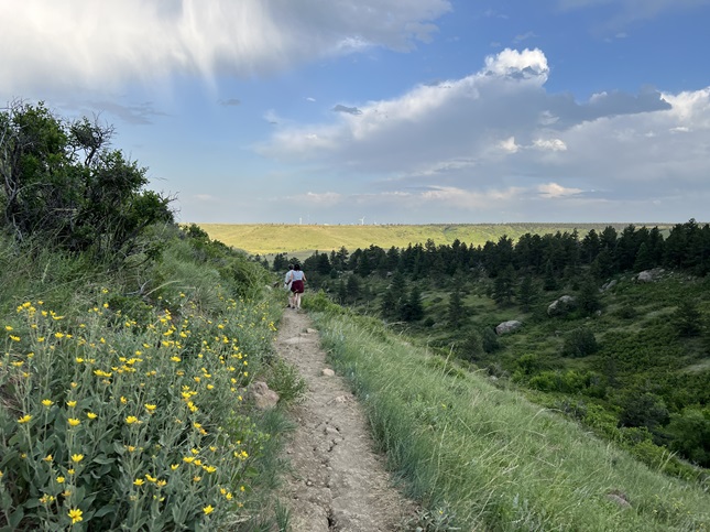
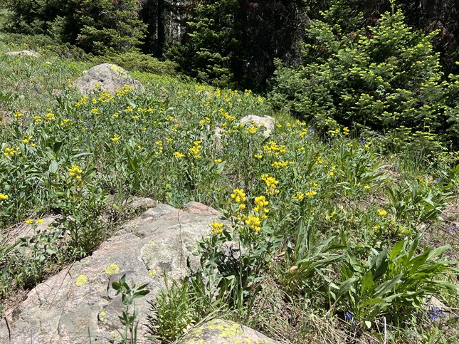
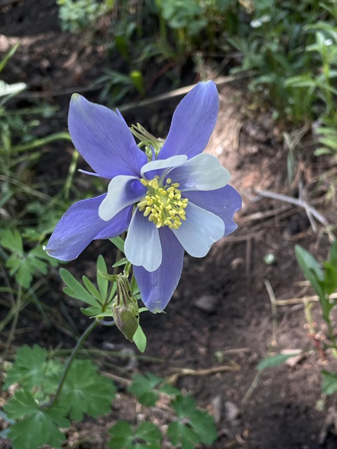
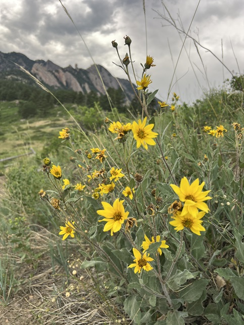
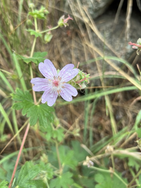
22) Homestead, Shadow Canyon Spur, Mesa and Towhee Trails, South Mesa Trailhead, Boulder Open Space & Mountain Parks, Boulder, CO, May 5, 2024 - In what has been an unusual Spring of hiking, mainly because travel has kept us busy, we have only hiked with our friend Desiree once so far this year and that was way back in January. So today with both us and her back from trips, we were finally able to meet up for a second hike in 2024. We headed for our usual spot - the South Mesa Trailhead - where we did the "medium" loop: Going up Homestead Trail to where it re-joins the Mesa Trail, then going up Mesa to the Shadow Canyon spur trail. We took that north until it re-joined the Mesa Trail at which point we took Mesa back towards the trailhead. We then used the Towhee Trail to short-cut and to return to the where we started. We had a gorgeous day for hiking with just a slightly cool temperature and a mostly clear sky. There early spring wildflowers were out so we spotted Blue Bells, Pasque, Cinquefoil, Mouse-Ear Chickweed, Starlilies, Chinese Crab Apple and Goose Plum. It was a great time for us to catch back up and all the wildflowers made it particularly nice to be hiking one of our "old standby" spring hikes. A 4.5 mile loop with 1,000 feet of elevation gain.
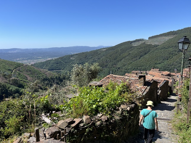
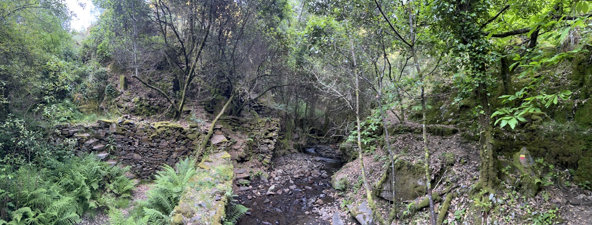
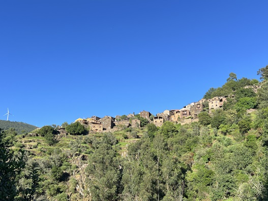
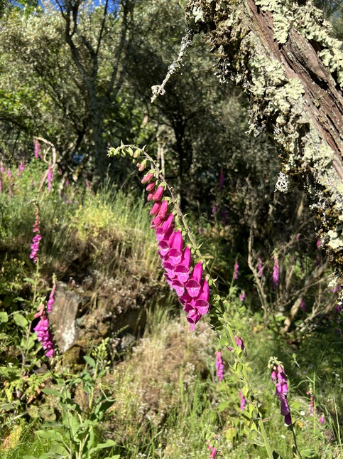
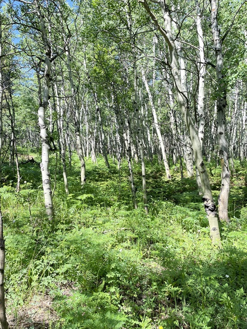
23) Rota do Marigo (PR8 LSA), Talasnal, Portugal, May 31, 2024 - We drove up into the central highlands of Portugal to visit one of the famous "Xisto" (Schist) villages. We chose the small village of Talasnal near the town of Lousã. We made the very twisty drive in the afternoon and then hung around until we could check into our mediocre lodging at 5pm. We then had a quick picnic dinner on the patio before heading out to do a short post-dinner walk on a marked trail that went down into the valley next to the village. The trail was steep down and steep back up but short enough to be doable before the sun set. We had low expectations for it since we were really just planning to stretch our legs after being in the car all day but it turned out to be amazing. The trail started by going down a ridge north of the city before pealing off the ridge and dropping down into the valley to the west. Then the trail turned south and climbed up the valley alongside the creek at the bottom. Once we were down in the valley it was like we'd stepped through a magic portal into a fairy tale. The sides of the valley were terraced with stone walls but they were everywhere and they seemed unimaginably old. The area had been abandoned in some ancient era and were now falling down, covered with thick green moss, cross-crossed by fallen tree trunks and threaded with flowering vines. The creek's channel had likewise been built up with stone and then bridged with stone arches, lichen covered wooden plaforms made from downed trees and big flat granite slabs. There were stone foundations of long missing buildings and overgrown side trails leading into thickets of brush. The trail was marked but the forest was so thick it was tricky to spot the periodic painted hashes made on rocks and tree trunks. The trail was also narrow, rocky and muddy. Sometimes it was just a narrow ledge along a rocky cliff face so it definitely wasn't for the inexperienced hiker. Because it was late spring and this area is so lush the entire area was also covered with wildflowers, which meant the air was buzzing with bees, flittering with butterflies and twittering with birds. At any moment we could have stumbled over a misty bridge and into Brigadoon and it wouldn't have been out of place. Stunningly beautiful and felt much longer than the 1.4 mile listed on the sign back in Talasnal. A 1.4 mile loop with 321 feet of elevation gain.

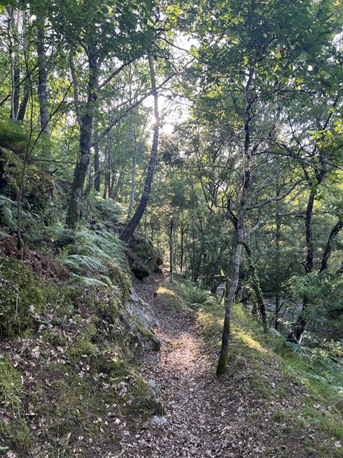
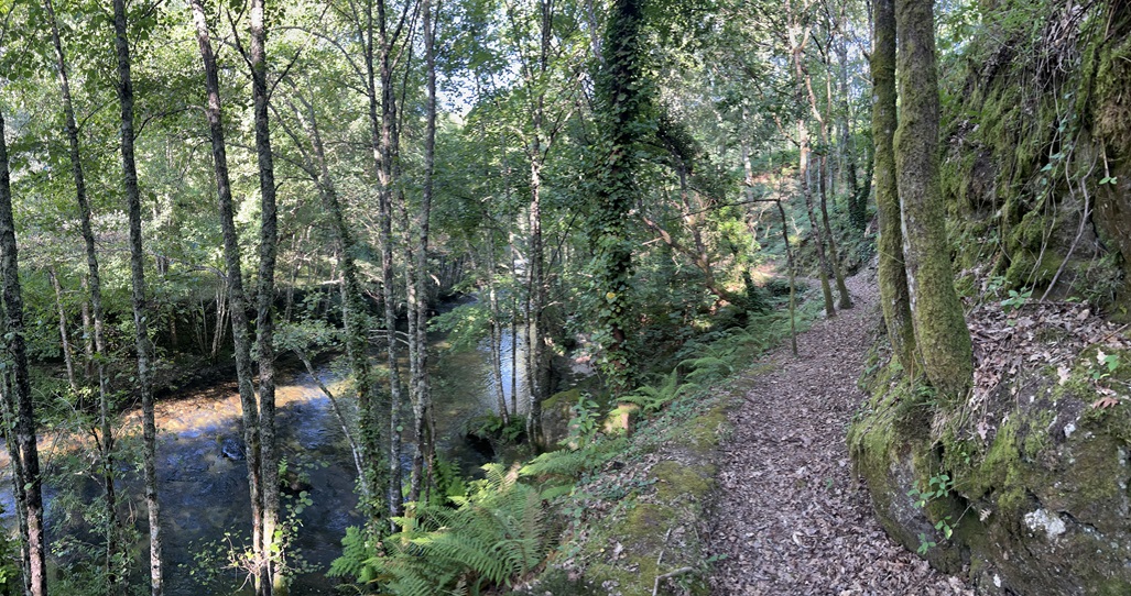
24) Rio Alva Trail, Vila Cova à Coelheira, Portugal, June 1, 2024 - We had such an incredible experience with an after dinner hike the previous day we decided to do it again. After arriving at our adorable hotel in the tiny village of Vila Cova à Coelheira we followed our host's advice and did a 2 mile loop along the river behind the hotel. The trail followed the Alva River but on a ledge about 20 feet above the water. This area wasn't quite as lush but will still a rich forest filled with Oak, Chestnut and Cork trees. Add in the ferns and moss and wildflowers and it was a natural botanic garden. The crunch of the dry leaves, the trickle of the river current and the twittering of the birds made it a sublime and peaceful place. Moreso, since we had the entire trail to ourselves. A 2 mile loop with a basically flat 70 feet of elevation gain.
25) Rota Da Garganta De Loriga (PR5 SEI), Salgadeiras Trailhead, Serra da Estrela Nature Park, Loriga, Portugal, June 2, 2024 - Our next hike was just about the highest elevation hike you can do in Portugal as it is near the summit of Serra da Estrela, the tallest mountain in Portugal at 6,539 feet. This hike started at 6,000 feet which, for reference, is about 2,500 feet *lower* in altitude than out house in Colorado. Nonetheless, hiking in a Nature Reserve, as well as on top of a mountain, meant it would be a scenic hike. We parked at the Salgadeiras trailhead and then started down the Garganta de Loriga glacial valley. This trail runs from just below the summit all the way down to the village of Loriga following a stream drainage. We didn’t have the two cars necessary to do it as a through hike so we started at the top, hiked partway down and then turned around and returned to the car backtracking up the trail. Along the way we hiked through the rocky landscape carved by an ancient glacier with many giant erratic boulders spread over the mountainside. This area wasn’t covered with the scrubs we had seen on our drive the previous day that were covered with yellow flowers but there were a few of them scattered around. There were lots of other wildflowers on the hike which meant there were also bees and butterflies flitting from bloom to bloom. There are lots of little springs and streams at the head of this valley and a series of reservoirs have been build to capture all this snow melt. The result is a hike through lush fields with winding streams that flow into man-made lakes, then do the same in the next flat area below that. After hiking about a half a mile we stopped at a little pond beside the trail and it was full of little green frogs. They were making all sorts of different noises but would go silent and swim away if we got close so we played a bit of a game trying to watch and listen to them without frightening them away. We continued down the valley and eventually arrived at Albufeira do Covão do Meio which is the largest of the reservoirs along this valley. After hiking around the edge we went out on top of the dam which allowed us to look down way the valley to where it seemed to drop off the side of the mountain. We decided to turn around at this point since every step down would mean having to climb back up another on the way back. The ascent was slow but steady with another quick stop to listen to the frogs as we passed their pond. The weather was absolutely perfect for a hike - sunny but cool with hardly any clouds in the sky. We couldn't ask for a better day to explore Portugal's highlands. A 3.2 out-and-back hike with 800 feet of elevation gain.
26) Caniça Route (PR10 SEI), Praia Fluvial (River Beach) trailhead, Lapa Dos Dinheiros, Portugal, June 3, 2024 - After skipping our second hike yesterday we decided to squeeze in one in the morning before we left the mountains behind and returned to the coast. In the next town over from where our hotel was located was a hiking trail that had been recommended by two different people so the combination of high regard and close proximity made that our goal for the morning. We drove up to Lapa Dos Dinheiros and found the trailhead next to Praia Fluvial (River Beach). The trail ended up being pretty strenuous - lots of elevation change all throughout the hike - and the scenery also varied greatly. There were portions where the trail used old dirt roads and most of these areas were kind of boring. However, there were some sections that were fantastic. About a quarter of the trail ran alongside an old irrigation ditch - I’d guess multiple hundreds of years old - which had an amazing variety of wildflowers along it. At the head of the irrigation ditch was a perfect swimming hole surrounded by gorgeous moss covered rocks. Another section contained a little hidden grotto that was straight out of a 17th century mythological painting with moss covered trees, a perfect trickle of a waterfall and a crystal clear pool of water. It was just missing a satyr or faerie to be complete. The quality of the trail was also highly variable with the section along the canal being perfect while some other places were overgrown with head-high grass or ferns. There was one short section that was full on rock climbing. Anyway, it was an adventure and I am glad we got a chance to hike again before going to a big city for our last few days in Portugal. A 4.4 mile loop with 1,200 feet of elevation gain.
27) Homestead, Mesa and Towhee Trails, South Mesa Trailhead, Boulder Open Space & Mountain Parks, Boulder, CO, June 10, 2024 - As soon as we returned from our month long European vacation we turned our attention to our neglected tradition of hiking down in Boulder with our friend Desiree. We resumed the Sunday evening hiking by meeting up at the usual trailhead, the South Mesa Trailhead, and then hiking our usual trails - Starting on the Mesa trail, then turning west on the Homestead Trail to where it rejoins the Mesa trail. From there we started up the Mesa Trail towards Shadow Canyon but turned back early and returned on Mesa Trail to where the Twohee Trail cut-off branches off. We took that back to where it rejoins the Mesa Trail and then returned to the trailhead. It was a lovely evening with just enough clouds in the sky to keep the temperature down to an enjoyable level. The summer wildflowers were blooming all along the sides of the trail and we saw both turkeys and deer dining on the lush green hillsides along Towhee Trail. It also gave us plenty of time to swap travel stories with Desiree and catch-up on each other's lives so an enjoyable evening all around. A 4 mile loop with 750 feet of elevation gain.
28) Homestead, Mesa and Towhee Trails, South Mesa Trailhead, Boulder Open Space & Mountain Parks, Boulder, CO, June 16, 2024 - For the second weekend in a row we were back to our regular hiking schedule with Desiree. We again met up at South Mesa Trailhead and did our usual loop. This time we just stuck to the "short" loop but we did mix things up a little hiking even later in the evening. We started after 5:30pm and the sun was setting as we got back to the trailhead. We saw even more wildflowers this Sunday than we'd seen just a week ago but we didn't spot any critters so scenery wise it was a wash. However, we did spot a rainbow off to the east just before we got back to the trailhead so that was our gift for the hike. A 3.2 mile loop with 600 feet of elevation gain.
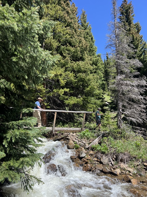
29) Forest Lakes trail, James Peak Wilderness Area, East Portal Trailhead, Tolland, CO, June 17, 2023 - Another unusual situation for this year's outings has been the lack of hiking with our friend Lyle. We made up for that by getting together with Lyle at the East Portal Trailhead for our first hike of the year into the James Peak Wilderness Area. We had a perfect day for hiking without a cloud in sight and cool temperatures (on a day when it was scalding hot down on the plains below). The summer wildflowers aren't in full swing yet but there were still bunches of blooms in the open areas that get direct sunshine. What was in full swing was Arapaho Creek which was overflowing its bank as it rushed down the side of the valley to join South Boulder Creek. We hiked up the Forest Lakes trail to the bridge over Arapaho Creek where we enjoyed the cacophonous waterfall there before turning back and backtracking to the trailhead. A nice hike and also a great time catching up with Lyle. A 3.8 mile out and back with 700 feet of elevation gain.
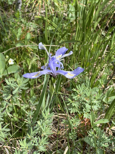
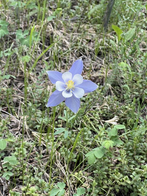
30) Mud Lake, Boulder County Parks & Open Space, Nederland, CO, June 19, 2024 - Our summer hikes have focused on catching up on hikes with friends and we continued that again this week when our friends Kristin and Steve drove up from Boulder to hike the "long" loop at neighboring Mud Lake. Once again the mountains delivered cool temperatures and a partly cloudy sky which made for perfect hiking weather. The summer wildflowers at our elevation were also in full swing with at least a dozen different varieties of flower visible during the hike with wild Irises and Colombines being my favorites for the hike. What was a surprise was how crowded the trail was - presumably because June 19th is now a Federal holiday which meant there were a lot of people with time off so they could enjoy the outdoors, but also because there appeared to be a kid's mountain bike camp going on with lots of very polite youngsters learning both the technical and social skills required to pedal in the mountains. We had a fun time catching up with our friends and thoroughly enjoyed seeing our local trail looking so nice. An easy 2.3 mile loop with just 250 feet of elevation gain.
31) Mud Lake, Boulder County Parks & Open Space, Nederland, CO, June 20, 2024 - We enjoyed hiking the Mud Lake trail so much the previous day that we did it all over again. Our friend Linda stopped by our place on her way home from a long, semi-crosscountry, motorcycle trip. We wanted to show her a little glimpse of our beautiful part of the world so we brought her over to Mud Lake for a quick hike in the morning before she took off to resume her trip. We had the same gorgeous weather and scenery as our previous hike but also nearly empty trails so we could properly show off the place. We enjoyed getting to hike with Linda and hopefully she got a glimpse into why we love living in the mountains. An easy 2.2 mile loop with 250 feet of elevation gain. (Photo credit to Linda Cicero.)
32) Homestead, Mesa and Towhee Trails, South Mesa Trailhead, Boulder Open Space & Mountain Parks, Boulder, CO, June 30, 2024 - Despite all three of us feeling very low energy Desiree, Jonna and Alan all dredged up enough motivation to get together for our usual Sunday evening hike. We once again got together at 6:30pm which allowed us to avoid the heat of the day but meant we would start the hike with dark storm clouds hovering over our heads and with the rumbling of thunder echoing off the Front Range mountains. The recent baking hot weather has cooked most of the wildflowers into shriveled brown husks but a few varieties of flowers were thriving with all the sunshine - Crested Prickly Poppies, Yarrow, Coneflowers and Meadow Arnica. The clouds gave us a few sprinkles just as Homestead trail connected with Mesa Trail so we decided to turn back there. Thankfully, despite the ugly looking gray sky, the heavy rain held off. Those clouds did make for some dramatic views looking back on the mountains as we hiked out on Towee Trail and weirdly contrasted with spots of blue sky that was visible off to the south. We ended the hike with a close-up view of a pair of young deer out enjoying the tall summer grass. A 3.2 mile loop with 600 feet of elevation gain.
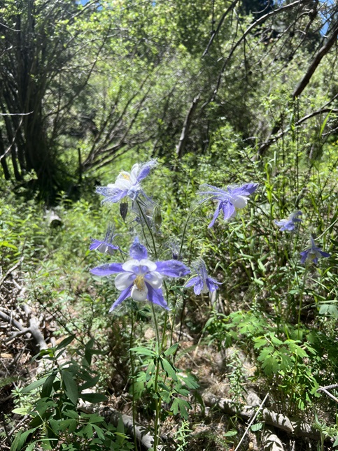
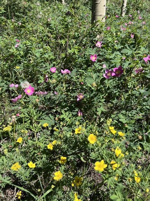
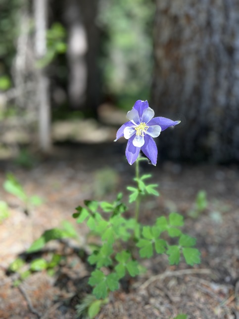
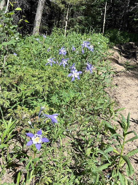
33) Ellsworth Creek trail system, Rollinsville, CO, July 3, 2024 - We have found that one of the best places to see huge numbers of Colombine flowers this time of the year is the Ellsworth Creek trail system. We have been enjoying doing wildflower walks with our friends Kristin and Steve so we invited them to come up and check out the Colombines this year to see if they were as plentiful as we'd seen in years past. We met up at the West Magnolia trailhead and then carpooled into Gilpin county to the Ellsworth Creek parking area. We then hiked the "short" loop which runs through the prime Colombine area. We weren't disappointed! There were tons of them! One of the other interesting things we've seen this time of the year are a willow-like tree that grows on the banks of the creek and which fills the air with fuzz that is apparently some sort of seed. All this fuzz appears to be particularly attracted to Colombines which means that most of the hundreds of blossums are coated with fine white fuzz. In addition to the purple flowers the area also had a large variety of other wildflowers that were in bloom - The pink wild Roses, white Geraniums, Sulfur Indian Paintbrush, yellow Cinquefoil, purple Penstemon, Silvery Lupine, Scarlet Indian Paintbrush, tiny white Mouse-ear Chickweed and cream colored Drummond's Milkvetch. I am sure that list is incomplete but hopefully gives some idea of how plentiful the flowers were on this short hike. I'd say we can count our goal of "lets go see lots of Colombines" as a unqualified success! A mellow 2.1 mile loop with 140 feet of elevation gain.
34) Ellsworth Creek trail system, Rollinsville, CO, July 4, 2024 - We enjoyed the wildflowers at Ellsworth Creek so much yesterday we did it again today. Our friends Desiree and Gaelin came up from Boulder for an afternoon hike and we were once again lucky to have the trail to ourselves. In addition to hiking the loop we did yesterday we also made the climb up to the old Ellis Lode Mine and took a look at the meadow just above it. We had a beautiful blue sky filled with white puffy clouds that contrasted nicely with the green field of colorful wildflowers. I'll always prefer the brightly colored bunches of blossums exploding in a field of green over fireworks to celebrate the 4th of July! A 3.9 mile out-and-back with 900 feet of elevation gain.

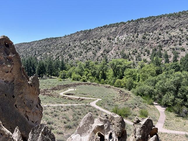
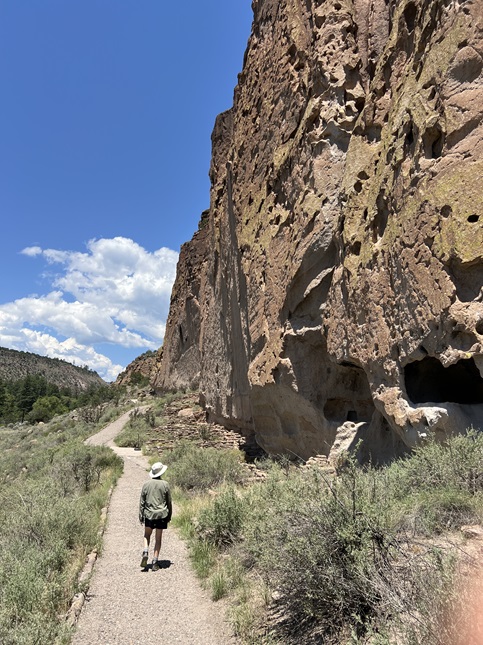
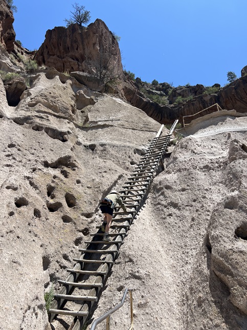
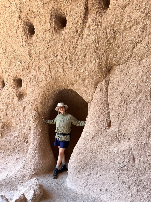
35) Pueblo Loop Trail, Bandelier National Monument, White Rock, NM, July 11, 2024 - We made a quick trip down to Santa Fe to visit the annual International Folk Art Market and had a free day so we drove up to Bandelier National Monument to see the canyon and its Ancestral Puebloan cliff dwellings. The only access to the canyon in the summer is via a shuttle bus from White Rock which means our hiking was limited to what we could access from the main visitor center. Since we only had a couple of hours we defaulted to the most popular one - the Pueblo Loop Trail that runs along the northern wall of the canyon and which has a mostly continuous string of dwelling sites and that ends at the Alcove House up on the cliff wall. It wasn’t a long or challenging hike - it was actually paved for half the distance - but it was cool to see all the caves, crumbling walls and other ancient living spaces. Well worth the side trip up from Santa Fe.
36) Mud Lake, Boulder County Parks & Open Space, Nederland, CO, July 14, 2024 - On a day when the temperatures down outside the mountains was pushing 100 degrees, we were happy that Desiree was willing to drive up to our neck of the woods for our weekly evening hike. A few clouds, the setting sun and some decent tree cover meant we could hike in comfort. For location we just headed back over to Mud Lake to hike the "long" loop there. We had originally thought we'd explore the new loop formed by the recently opened Chickadee and Sherwood Forest trails but after looking at Google Earth we decided the usual Tungsten and Kinnickinnick Loop trails were more shaded so we stuck to those. There are still quite a few wildflowers out in the Mud Lake area so we got to enjoy those as well as some nice views of the sun setting behind the Continental Divide. The same easy 2.2 mile loop with 250 feet of elevation gain that we've done a few times over the past month.
37) Anne U. White Trail, Boulder County Parks & Open Space, Nederland, CO, July 21, 2024 - Despite rain and lightening lashing the mountains the weather down in Boulder was mild so when friend Steve suggested a mid-day hike Alan drove down the hill. We decided to head to the Anne U. White trail, one Alan last hiked way back in 2020, and it was a fine choice. The trail was damp but we had no rain for the hike in to the turn around point. There were a surprising number of wildflowers still in bloom considering how little water was flowing in Fourmile Canyon Creek. All the flowers meant we also saw about a dozen hummingbirds which was a nice surprise. As we hiked back out we got a little sprinkle of rain but by the time we got out rain gear on the rain had moved on. The trail is still a pretty one and gave us plenty to enjoy for our Sunday outing. A 3.4 out-and-back with an easy 500 feet of elevation gain.
38) Arapaho Glacier trail, Rainbow Lakes Trailhead, Roosevelt National Forest, Ward, CO, July 26, 2024 - Our hikes for most of this year have been short and many at lower elevations but today we finally set our sights on getting up into the high country. Because the trails can be so busy on weekends we decided to head out early and to avoid the most popular trails. With that in mind we headed down the long, bumpy Rainbow Lakes road to hike one of our favorite trails - The Arapaho Glacier trail. At first, it looked like we had waited a little too late into the summer to hike here because both the trailhead and the lower part of the trail was completely devoid of wildflowers - and the flowers are often one of the highlights of this hike. However, by the time we got up to the middle part of the trail we started to see lots of Silvery Lupine so at least we knew there were a few flowers still in bloom. The real show started right at treeline where the pine forest gave out and the alpine tundra began. Right at the transition point there were hundreds of bright red Indian Paintbrush and equally bright yellow Golden Banner. Once we were up onto the tundra it was obvious that the season for some of our favorite flowers like Old Man Of The Mountain and the Alpine Daisies was past but the tundra was covered with purple Hare Bells, yellow Buttercups, tiny pale white Fendler's Sandwort and little bunches of Yellow Stonecrop and sprigs of snow white Yarrow. The view out over the line of Triple Lakes, Goose Lake, Island Lake and Silver Lake was as spectacular as always. The weather forecast called for rain at noon and we could see clouds building up so after enjoying the view we turned and headed back down - getting down to the and all the way back home before the raindrops started to fall. A 5.3 mile up and back with 1,100 feet of elevation gain.
39) Michigan Lakes, American Lakes trail, State Forest State Park, Gould, CO, August 5, 2024 - Jonna and I took the camper out for a little shakedown test camp-out to make sure everything is working before heading out on a longer trip in the Fall. We chose State Forest State Park up at Cameron Pass on the northern edge of Rocky Mountain National Park. The state park has a number of hiking trails, as well as various roads which are used for winter sports but are closed to motor vehicles in the summer. We chose to hike up to the Michigan Lakes along the American Lakes trail via the Crags Campground trailhead. The trail starts at around 10,000 feet of elevation and then climbs up to over 11,200 feet, starting on the northern shoulder of Nokhu Crags mountain and looping halfway around the to end in a bowl between Nokhu Crags and Static Peak. This mean we were hiking in a mix of terrain including Lodgepole pine forest, a riparian zone along the headwaters of the Michigan River and then the tundra up above treeline. The real treat were all the wildflowers, especially along the Michigan River headwater stream. There was such an incredible bounty of wildflowers, both in quantity and variety, that it will be my memory of this hike even more than the beauty of the alpine lakes we were hiking to. We also spotted to reclusive high altitude residents that are always highlights when seen - First, a Ptarmigan hen with a brood of chicks and then higher up we saw Pika scampering in the talus slopes above treeline. A terrific hike and an area we plan to come back explore more. A 6.4 mile up and back with 1,300 feet of elevation gain.
40) Gould Loop Trail, State Forest State Park, Gould, CO, August 6, 2024 - After our terrific alpine hike the previous day we decided to do something different for our second day of camping at State Forest State Park. The south fork of the Michigan River flows through the campground area and the Gould Loop Trail runs alongside it all the way to the State Park Visitor Center. This provided the possibility of spotting a moose so we decided to give it a try. Unfortunately, the exceedingly hot weather meant it was well into the 80s when we started the hike mid-morning and that probably doomed our moose spotting as they were probably bedded down in the shade to avoid the heat. That wasn't a bad idea for people too but we soldiered on despite most of the trail running through areas that had been cleared of trees subjecting us to direct sun for much of the hike to the Visitor Center. We spent some time using the Visitor Center wifi and then started back. For the return we crossed over the river and hiked back along the river along the southern side. The trail there was slightly higher up above the river valley and more of it was in forest so we got some shade from the afternoon sun. We spotted a hawk up in a dead tree and about a thousand grasshoppers but I think all the sensible critters opted to lay low and try to stay cool. A 6.3 mile loop with a mellow 200 feet of elevation gain.
41) Ellsworth Creek trail system, Rollinsville, CO, August 11, 2024 - Our new-ish friend Jordin, who house sat for us during our recent Europe trip, was back in the Denver area this weekend and was willing to drive back up into the mountains so we could re-connect. She brought along the dog she is house-sitting and we all headed out to one of our "local's only" trails to search out a few late season wildflowers. We knew rain clouds were on the way but we were lucky to have sunshine for our hike from the Ellsworth Creek "trailhead" up to the Ellis Lode mine. We made the climb to the upper meadow so Jordin could see the Continental Divide view and we all got to watch dark storm clouds flowing over the high peaks and dropping down the valleys. The wildflowers were past their peak but there were still plenty of Yarrow, Hare Bells and Cinquefoils as well as a few Indian Paintbrush and Gentian. Clouds blotted out the sun as we hiked back down the mountain and we got hit with a few raindrops but overall we timed the hike perfectly. A fun time catching up with a super interesting person and we got to enjoy beautiful views before the afternoon was overtaken by much needed rainstorms. 4.5 miles up and back with 900 feet of elevation gain.
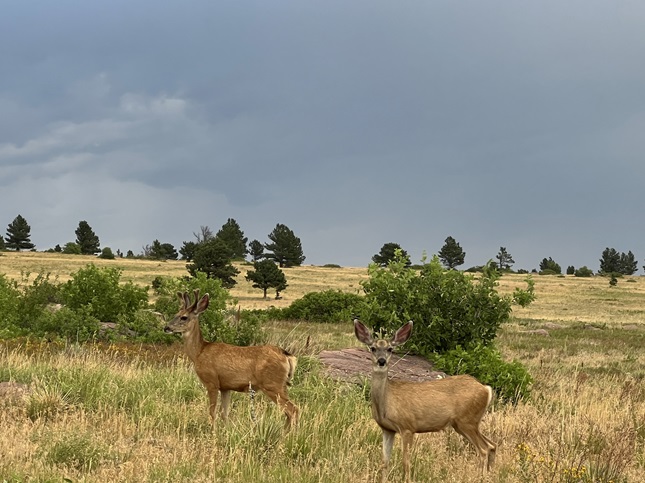
42) Mesa and Homestead Trails, South Mesa Trailhead, Boulder Open Space & Mountain Parks, Boulder, CO, August 25, 2024 - This was Alan's first hike after his motorcycle accident and it was a bit of an eye-opener. Alan and Jonna met up with Desiree at our usual spot - the South Mesa Trailhead. The sky was dark and seemed to be threatening to rain at any moment but we decided to head out anyway with the goal of hiking the "short" loop. Unfortunately, the body movement of hiking on a trail with all the small impacts going up and down rocks caused more soreness than anticipated for Alan so we ended up turning back before we got to the point where the Homestead Trail meets up with the Mesa trail. We got a few light sprinkles on the way back but fortunately the clouds held off from dumping on us. Despite the abbreviated hike it was still nice for Alan to get in some physical activity and we all enjoyed seeing a few critters - A big bull elk and then later two spotted mule deer fawns. We also had time to catch up with Desiree to hear about her recent trip so all-in-all it was a successful outing even if it was a big shorter than planned. A quick 2.2 mile out and back with a mild 350 feet of elevation gain.

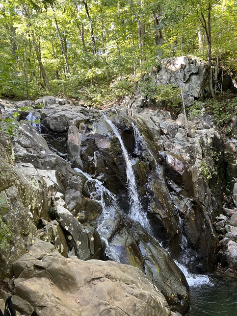
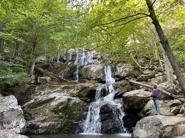
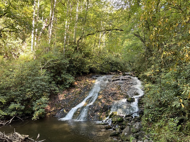
43) Appalachian Trail, Keyser Run Trailhead & Overall Run Falls Trail, Mathews Arm Campground both in Shenandoah National Park, Front Royal, VA, September 7, 2024 - Jonna and Alan's first hiking stop on our late summer RV trip was on our first day in Shenandoah National Park. Alan's recent motorcycle accident injuries meant he was unable to do long and/or super strenuous hikes so we made the decision to do multiple short hikes each day in order to see as much as possible of the National Park. Our first hike on our first day was a short section of the Appalachian Trail starting at the Keyser Run Trailhead and hiking west toward Hogback Overlook. It has rained during the night and thick fog was still floating through the Shenandoah River valley so the hike was wet and muddy and drippy. Little drops of rain still clung to spider webs and balanced on wildflower petals. We hiked to where the trail start climbing up the Hogback before deciding to turn back. It was a beautiful first hike in the hardwood forests of the Appalachian Mountains. In the evening, after we got set up at our camping stop in the Mathews Arm Campground, we headed out for another hike this one starting directly from our campsite. We hiked north from the campground on the Mathews Arm Road to the Mathews Arm Trail. That dropped us down into a valley where we met up with the Overall Run Trail which brought us down to the Overall Run Falls. Low water flow meant the falls were a bit underwhelming but the hike itself was lovely and reversing the route to climb back up out of the valley gave us a nice workout to get our legs back in shape after a week of sitting in the RV's seats as we drove east. The details on the two trails are: Appalachian Trail was a 2.1 mile out and back with 600 feet of elevation gain. Overall Run Trail was a 4.2 mile out and back with 850 feet of elevation gain.
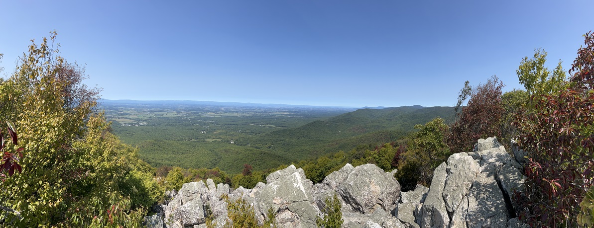
44) Upper Hawksbill Trail, Upper Hawksbill Trailhead and Rose River Falls Trail, Big Meadows Campground both in Shenandoah National Park, Swift Run, VA, September 8, 2024 - For our second day in Shenandoah National Park we again did two hikes, one in the morning and another in the late afternoon. Our first one was the climb up Hawksbill Mountain from the Upper Hawksbill trailhead. The day was a beautiful, sunny day which dried up the trails after the previous day's rain. This is the "easy" trail up Hawksbill rather than the Appalachian Trail ascent which is much steeper. As a result it was an easy stroll on a wide trail which ends at a viewing platform that offers a magnificent panoramic view out over the Shenandoah River valley. We enjoyed the view and then returned to the camper to continue our drive south. In the late afternoon we got set up at a campsite in the Big Meadows Campground and then headed out for another hike straight from our campsite. We hiked a section of the Appalachian Trail from the campground to the Fishers Gap Overlook where we then picked up the Rose River Loop Trail to drop down into the Rose River valley. It was a steep descent with some big switchbacks but through the same beautiful hardwood forest we'd enjoyed on the previous hikes. The river was small but with enough water flowing through that the waterfalls were worth the visit. We reversed our track and returned via the same route. On the way back we encountered a small herd of deer that were so accustomed to humans that we had to hike quickly away from them because they were trying to approach us, presumably think we would feed them. The details for the two trails are: Upper Hawks Bill Trail was a 2.2 mile out and back with 900 feet of elevation gain. Rose River Falls Trail was a 5.3 mile out and back with 1,200 feet of elevation gain.
45) Dark Hollow Falls Trail, Dark Hollow Falls Trailhead and Turk Mountain Trail, Turk Gap Trailhead both in Shenandoah National Park, Swift Run, VA, September 9, 2024 - For our third and final day in Shenandoah National Park we once again split our hiking into two different short hikes. The first was right across the road from our campsite. We drove over and parked in the Dark Hollow Falls Trailhead parking and then hiked down the Dark Hollow Falls Trail to Dark Hollow Falls. This was a very short but quite steep trail but the waterfall at the bottom was well worth it. It was the largest of the waterfalls we'd seen thusfar and the wildflowers down in the valley were particularly lovely. We also spotted deer on both our hike down and then more as we hiked back out so it got high marks for wildlife as well. For our afternoon hike we got advice from a park ranger so we stopped at the Turk Gap Trailhead and made the climb up to the summit of Turk Mountain. This trail had three highlights. The first was a short section of the trail in a bottom just before starting the climb up the peak where there are a few straggler American Chestnut trees. These trees are functional extinct as there aren't enough left to ever re-establish a forest but there are a few stragglers still clinging to life along this trail. The American Chestnut was devastated in the early 20th century so hiking in the midst of the few remaining examples was a cool experience. The second highlight was near the very top of the trail where a section of the trail crossed a quartzite talus slope. The rocks in this section contains interesting marks that look like someone ran a rake over the stone. These marks are actually Skolithos trace fossils which are ancient tubeworm holes made in what was once beach sand. Finally, there was the summit which offered a spectacular 360 degree showing the Shenandoah Valley to the west and then back onto the Appalachian Mountains to the east. The details of the trails are: Dark Hollow Falls Trail was a 1.4 mile out and back with 500 feet of elevation gain. Turk Mountain Trail was a 2.5 mile out and back with 700 feet of elevation gain.
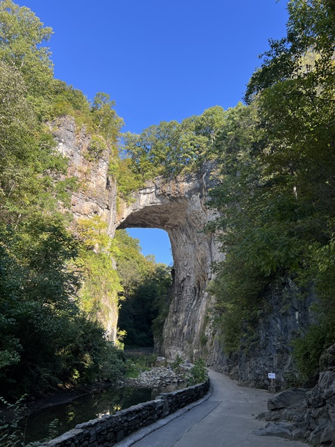
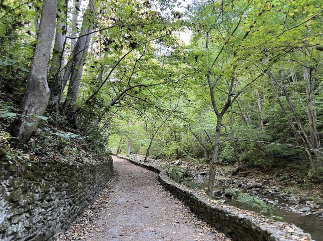
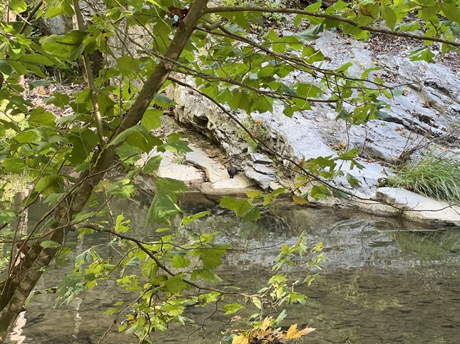
46) Natural Bridge Trail, Natural Bridge State Park, Natural Bridge, VA, and the Trail Of Trees, Virginia Department of Wildlife Resources, Big Island, VA and Johnson Farm Trail, Blue Ridge Parkway National Park, Bedford, VA on September 11, 2024 - On our fourth day we left Shenandoah National Park and started south down the Blue Ridge Parkway. After a day of traditional sightseeing we started our fifth day with another set of hikes. Our first hike of the day was in Natural Bridge State Park. We parked at the Visitor Center and then hiked down into the Cedar Creek Valley, past Cascade Falls, to the Trail Store. From there we saw the Natural Bridge and then hiked the well maintained trail north along Cedar Creek to see the Saltpeter Cave, the Lost River cave and Lace Falls. The highlight of this hike was spotting a river otter and watching it scamper along the rocks on the other side of the creek from us. Later in the morning as we drove down the Blue Ridge Parkway we stopped at the James River Visitor Center to enjoy the views over the James River and then to hike the short "Trail of Trees" loop. This quick walk was worth mentioning mainly because the trail was set up with signs indicating each variety of tree found along the trail which allowed us to identify some of the species of trees we knew were in the area but that we didn't know what they specifically looked like. Our third and final hike of the day was one we could do from our campsite at the Peaks of Otter Campground. From our campsite we hiked a connector foot trail down to the Abbott Lake trail which we used to loop around to the north side of the lake. From there we picked up the Johnson Trail which we hiked around to Johnson Farm. The old apple trees on the farm were loaded down with fruit which, combined with the pictureque farm house, made for a quaint view into the history of the area. From there we finished the loop and hiked over to the visitor center but found it closed. Then we picked up the original footpath which went past a country store which just happened to sell ice cream bars. Yum! we then hiked back up the hill to our campsite. A trio of nice hikes that allowed us to enjoy a beautiful day in a beautiful area. The details for the three trails are: Natural Bridge Trail was a 2.5 miles out and back with a mild 280 feet of elevation gain. The Trail of Trees was a .5 mile loop with a mild 140 feet of elevation gain. The Johnson Farm Trail was a 4.3 mile loop with 600 feet of elevation gain.
47) Rocky Knob Picnic Loop Trail, Rocky Knob Recreation Area, Blue Ridge Parkway National Park, Conners Grove, VA, September 12, 2024 - Most of our next day was spent driving and checking out Roanoke but in evening just before heading to our campsite at nearby Rocky Knob Campground we did a quick hike from the Rocky Knob Visitor Center on their Picnic Loop Trail. This was an easy trail but that provided a nice mix of hardwood forest and meadows. We spotted a super cute spotted fawn that looked straight out of a Disney movie. Nothing too memorable but a good way to stretch our legs for the day. A 1.4 mile loop with 300 feet of elevation gain.

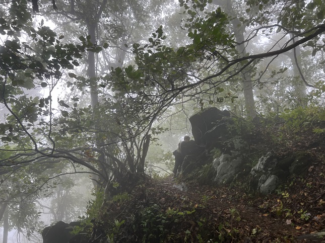
48) Rocky Knob Peak Trail, Rocky Knob Recreation Area, Blue Ridge Parkway National Park, Conners Grove, VA, September 13, 2024 - We got in the next day's hike right off the bat. As soon as we woke up we were out to hike up to Rocky Knob Peak which was right across the road from the campground. The weather was very foggy - almost to the point of being surreal. Visibility at times was barely beyond the length of an outstretched arm but would then suddenly open up to reveal the landscape as the low flying clouds blew over the ridge we were hiking on. The weather, combined with the lush forest, made for a very striking hike. Along the trail was an old stone shelter left over from when this section of trail was part of the Appalachian Trail (which was moved west quite some time ago). Oh, and (no surprise at this point) we saw more deer. It was a memorable, if drippy, hike and just as an experience was one of the best so far. A 3.5 mile loop with 800 feet of elevation gain.
49) Fisher Peak Trail, Blue Ridge Music Center, Blue Ridge Parkway National Park, Galax, VA, September 14, 2024 - This was another day with only one hike but it was a good one. We stopped off at the Blue Ridge Music Center to learn more about the history of music in the Appalachian mountains and, after lunch in the RV in the parking lot, decided to take advantage of the trails behind the visitor center. This turned out to be a great choice because apparently the trails aren't used by many of the visitors which meant we had them almost entirely to ourselves. We started with the High Meadow Trail which crossed some lovely little streams as well as some wildflower filled meadows. Then we turned onto the Fisher Peak Loop which climbed up a small mountain. This trail was very lightly used and allowed us to see what the natural landscape in this area looks - a tightly packed forest with pines, hardwoods and lots of scrubby underbrush. We didn't see any animals but we did enjoy the feeling of "wildness" which had us thinking we could see a critter at any moment. A 2.8 mile loop with 500 feet of elevation gain.
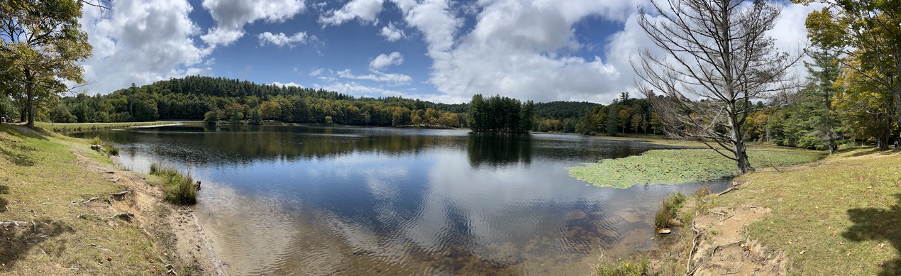
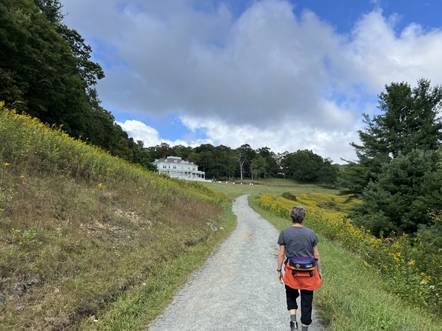
50) Bass Lake Trail, Moses H. Cone Memorial Park, Blue Ridge Parkway National Park, Ansley Heights, NC, September 15, 2024 - We crossed into North Carolina on the Blue Ridge Parkway and not long afterwards we stopped at the Moses H. Cone Memorial Park to check it out. This was the estate of a very wealthy 19th century industrial that was built around 1900 and in the mid-20th century it was transferred to the National Park Service. It is now a large park with 25 miles of hiking trails on the old carriage roads that wound through the old estate. We opted to do the "main" loop - starting at the Flat Top Manor (the main visitor center) on the Deer Park Road which drops down the hill all the way to Bass Lake. We then turned onto the Bass Lake Loop to go across the north side of the lake where we then changed over to Duncan Road to climb back up through Flat Top Orchard and return to the Manor. The terrain was a mix of heavily landscaped areas mixed with orchards and some semi-wild forest. Beautiful but also very crowded. We enjoyed the hike but were also glad to leave all the people behind as we continued south on the Parkway. A 4.6 mile loop with 400 feet of elevation gain.
51) Grandfather Mountain Trail, Grandfather Mountain State Park, Grandfather, NC and Linville Falls Trail, Blue Ridge Parkway National Park, Marion, NC on September 16, 2024 - After an overnight rain storm the day dawned damp but clear. We'd spent the night at Roan Mountain State Park in Tennessee but returned to the Blue Ridge Parkway to continue south. In the morning we stopped at Grandfather Mountain State Park where we made a short but steep hike from the lower parking lot up to the mile high viewing platform to enjoy the panorama looking out over eastern North Carolina. Not much of a hike but it was still nice to get a little exercise while enjoying also the famous swinging bridge at Grandfather Mountain. Just an hour later we pulled into the Linville Falls parking lot with dark clouds starting to fill the sky. There were two trails that lead to waterfalls and we chose the Erwin's View Trail. We made it to the Upper Falls Overlook before the rain began to fall but we decided to continue on to the Chimney View and Gorge View overlooks even with a light rain coming down. However, we did decide to skip taking the second trail - Plunge Basin - and instead headed back to the dry camper. So both of our hikes for the day were short but at least we were still getting out to see nature when we could. The details for the two hikes are: Grandfather Mountain Trail was a 1.2 mile out and back with 300 feet of elevation gain. Linville Falls Trail was a 1.8 mile out and back with a mellow 360 feet of elevation gain.
52) Buck Spring Trail, Mount Pisgah Inn Trailhead, Blue Ridge Parkway National Park, Woodrow, NC, September 18, 2024 - After a day off exploring Ashville, NC we were back driving the Blue Ridge Parkway and stopping to enjoy the amazing landscape we were driving through. We only made one stop on this day but it was a great one - hiking the Buck Spring Trail starting at the Mount Pisgah Inn. It was another misty and rainy morning but the sprinkles had stopped when we started the hike. The trail was muddy and low lying clouds were floating over the ridgeline. Sometimes we came to a break in the forest and had great scenic views while other times an overlook was covered by a cloud meaning we just saw white mist. The forest in this area is almost primeval and that feeling was enhanced by the fog and puddles. We hiked part of the way up Mount Pisgah but turned back once the trail got steeper and the mist got thicker. A 3.3 mile out and back with 800 feet of elevation gain.
53) Waterrock Knob Trail, Waterrock Knob Visitor Center, Blue Ridge Parkway National Park, Maggie Valley, NC and Deep Creek Loop Trail, Great Smoky Mountain National Park, Bryson City, NC on September 19, 2024 - Our final day on the Blue Ridge Parkway was a fine day with beautiful blue skies and very little traffic. We stopped at the last Visitor Center, Waterrock Knob, and did a short hike there to end our hiking in the Blue Ridge Parkway National Park. The Waterrock Knob Trail was short but steep climbing up the peak overlooking the visitor center. Once again we were rewarded with a gorgeous panorama looking out over the southern Appalachian mountains. From there we drove into Great Smoky Mountain National Park where we were camping at the Deep Creek Campground. This area is filled with trails so in the early evening we headed out to hike a loop that visits three different waterfalls. The Deep Creek Trail runs along Deep Creek but by two side creeks each of which forms a waterfall were they join. The first was the Tom Branch Falls and the second was Indian Creek Falls. Just after Indian Creek Falls we turned off onto the Deep Creek Horse Trail which we used to loop back towards the start. After a climb up and over a ridge we dropped down into the Juney Whank Branch valley where the third falls, Juney Whank Falls, was located. From there we continued around to return to our campsite. The details of the two trails are: Waterrock Knob Trail was a 1.2 mile out and back with 500 feet of elevation gain. Deep Creek Loop Trail was a 2.9 mile loop with 450 feet of elevation gain.

54) Little River Trail, Elkmont Campground, Great Smoky Mountain National Park, Gatlinburg, TN, September 20, 2024 - Our final hike on this month long RV trip was from our campground on the north side of Great Smoky Mountain National Park. The Little River Trail is a popular and well maintained trail that runs along the south bank of the Little River. The views of the river were sublime and the large trees of this hardwood forest made for a peaceful stroll. We had planned to make a loop out of this but the riverside was nice we decided to return the same way. A fitting way to end our time in the Appalachian Mountains. A 6.5 mile out and back with 450 feet of elevation gain.
55) Como Creek trail system, Nederland, CO, September 29, 2023 - When Jonna and Alan got back to Colorado from our month long RV trip there were still a some aspen trees hanging onto their bright yellow leaves. Our friend Desiree made the drive up from Boulder to join us for an afternoon hike to take in the last of the Fall colors. We parked at a side trail off the Peak-to-Peak highway and hiked down into the huge aspen grove along Como Creek. Most of the leaves there at already fallen but as we continued south on the Como Creek Trail we found trees that were still covered with golden leaves. We enjoyed the Autumn landscape and catching up with Desiree on what we've all up to for the past month. A 4.4 mile out-and-back with 275 feet of elevation gain.
56) Mesa, Homestead and Towhee Trails, South Mesa Trailhead, Boulder Open Space & Mountain Parks, Boulder, CO, October 7, 2024 - Jonna and Alan joined our friend Desiree for another evening hike at our usual trailhead - The South Mesa Trailhead. We did the "short" loop hiking up the Homestead Trail to where it re-connects to the Mesa Trail, then cam back via the Towhee Trail. As we hiked we watched the sun set behind the mountains and the local deer come out to feed on the grassy hillsides along the foothills. A 3.2 mile loop with 600 feet of elevation gain.
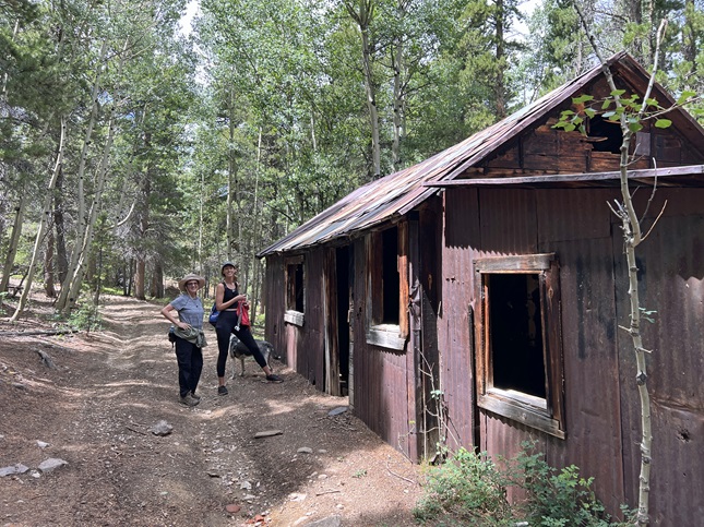
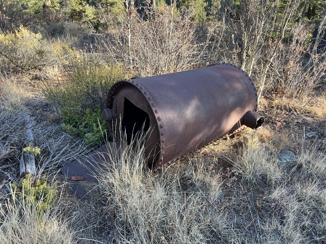
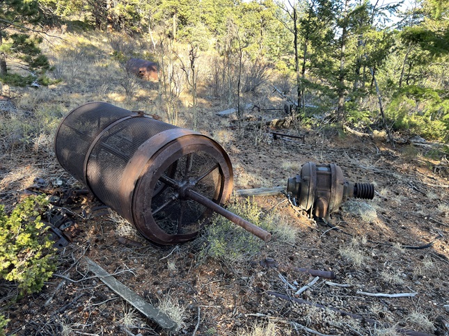
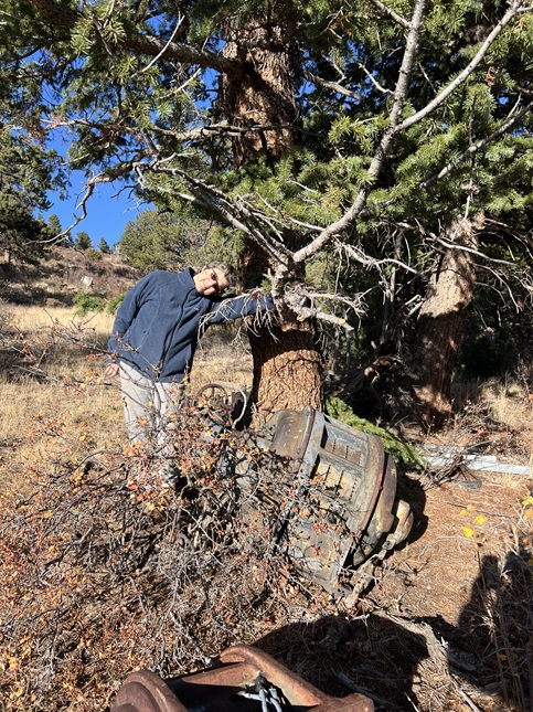
57) Vasco Mine #10, Nederland, CO, November 1, 2024 - Jonna had done a neighborhood hike with our neighbor which introduced her to a new trail. So on a Friday afternoon Jonna showed the trail to Alan. Back at the turn of the century the land in and around our neighborhood was part of the Vasco mine complex. Just down the hill from our house was the Vasco Mine pit #10 and there is a lot of old mining equipment scattered around that location. The most interesting of the artifacts were some huge electric motors and a small boiler - items which represent the time when mines were changing from steam power to electricity. After looking around at all the old mining gear we continued east along the ridge before leaving the main trail to head north until we connected to Ridge Road. Then we walked back along the road to our house. A short hike but with some interesting history to see along the way. A 3 mile loop with 250 feet of elevation gain.
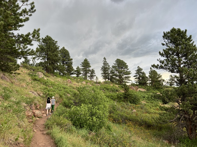
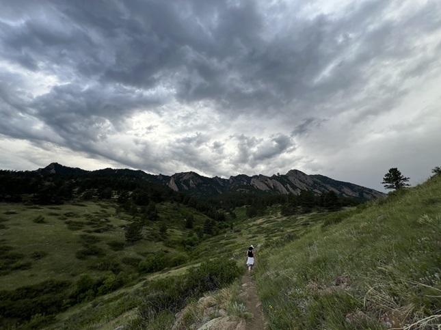
58) Chautauqua Park, City of Boulder Parks & Recreation, Boulder, CO, November 4, 2024 - With Jonna feeling under the weather, Alan joined our friend Desiree for a afternoon hike down in Boulder. It had snowed overnight but was warm enough during the day that the snow was melting as we hiked. We met up at the Chautauqua trailhead in Boulder and then strung together a mix of trails including Chautauqua Trail, Ski Jump Trail, Bluebell-Baird Trail, Mesa Trail and Enchanted Mesa Trail to make a loop through the park. Despite some snow, some mud and some cool temperatures we had a nice stroll. A 3 mile loop with 550 feet of elevation gain.
59) Chautauqua Park, City of Boulder Parks & Recreation, Boulder, CO, November 11, 2024 - During the past week we've had a few days of snow but the past couple of days have been sunny and warm. As a result when Desiree, Jonna and Alan met up at Boulder's Chautauqua Park for a Monday late afternoon hike the trails were a mix of dry, mud and ice. We did the same loop that Desiree and Alan did last week: Chautauqua Trail, Ski Jump Trail, Bluebell-Baird Trail, Mesa Trail and Enchanted Mesa Trail. However, we started a little later which meant the sun was behind the Front Range peaks when we started and the temperature was dropping as we hiked. We enjoyed a nice hike and tried to lift each other's spirits after the sad news of the recent election. A 3.2 mile loop with 550 feet of elevation gain.
60) Vasco Mine #10, Nederland, CO, November 15, 2024 - Our friend Julia stopped by for a short visit so we took the opportunity to show her the "new" neighborhood trail that we were just introduced to by a neighbor a month ago. The trail was mostly covered with snow but we all had good boots and snow gaiters so no problem with that. The mid-day sun felt great and was quickly melting the snow in the open areas so we could see some of the old mining equipment poking up through the snow. We went a little further down the trail before cutting cross-country back up to Ridge Road compared to what Jonna and Alan had done a couple of weeks ago but the trail continued to there is still more to explore. It was good to catch up with Julia and it is always fun to hike with her. A 3 mile loop with 250 feet of elevation gain.
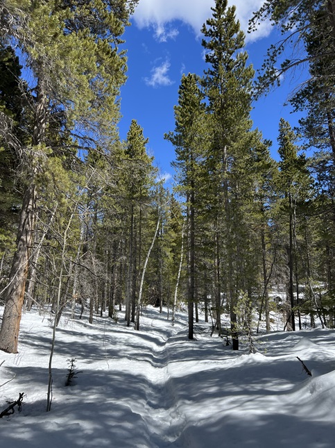
61) Sourdough Trail, Rainbow Lakes Road Trailhead, Nederland, CO, November 28, 2024 - A couple of days of snow turned the mountains into a picture perfect winter wonderland leading into the Thanksgiving holiday. Our friend Julia had an errand to run up in Nederland so we took her out for a hike in this beautiful landscape. We drove to the Sourdough Trailhead along the Rainbow Lakes Road and then headed north on Sourdough Trail. The snow was anywhere from ankle to knee deep and all the pine trees were piled high with fluffy white stuff. The weather was mostly overcast but the clouds were breaking up in places giving us glimpses of a soft blue sky overhead. We trudged through the snow while talking and enjoying the peaceful surroundings. We didn't hike very far but the snow made it a workout nonetheless. A 2.5 mile out-and-back trail with a mellow 350 feet of elevation gain.
62) West Magnolia Trail System, Nederland, CO, November 30, 2024 - Todd and Alan braved the crusty post-Thanksgiving snow to hike some of the trails in the West Magnolia trail system. We parked out at the end of County Road 132-W and started out on the Lookout Trail. We then took that over to the Hobbit 3 Trail around to where it met back up with Forest Service Road 355. We had planned to hike back on the Hobbit 2 trail but decided to head back on the road since we'd been post-holing through the old snow for the first half of the loop. Once back in the West Magnolia campground we took Forest Service Road 355-C around to the Observatory Trail which we used to get back to the trailhead. Unfortunately, the most memorable part of the hike was finding an abandoned campsite with tents, a gas stove and lots of other gear scattered around. The rest of the hike was through a quiet pine forest. We didn't see another soul for the entire hike. A 3.5 mile loop with 480 feet of elevation gain.
63) Mesa, Homestead and Towhee Trails, South Mesa Trailhead, Boulder Open Space & Mountain Parks, Boulder, CO, December 20, 2024 - With Jonna on the sidelines with a foot injury, Alan met up with Desiree for a final 2024 evening hike. We met up at the South Mesa Trailhead in the mid-afternoon and started our usual loop. We started out on Mesa Trail and then turned off onto Homestead Trail. With the sun low in the sky and hovering just above the Front Range mountains we had great light enjoying the scenery. We spotted a small herd of deer beautifully backlit by the setting sun. Once Homestead Trail met back up with Mesa we turned to head back - making this our "short loop" of the trails we have to chose from in this area. Just a litte way back we turned off onto Towhee Trail and took that back to the trailhead. The valley the Towhee Trail goes through was gorgeous in the "Golden Light" for the last bit of our hike we were in the shadow of the mountains with the temperature starting to cool off. Perfect timing and a lovely hike. A 3.0 mile loop with 550 feet of elevation gain.
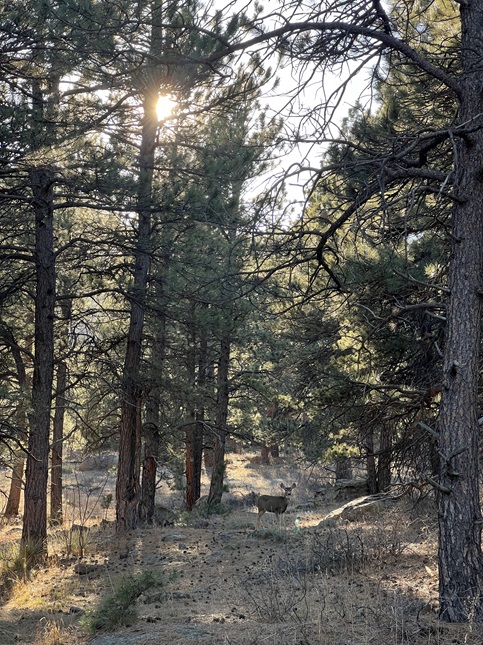
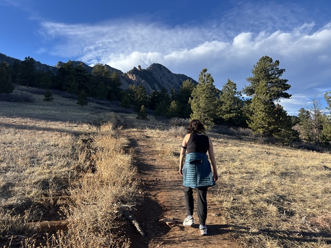
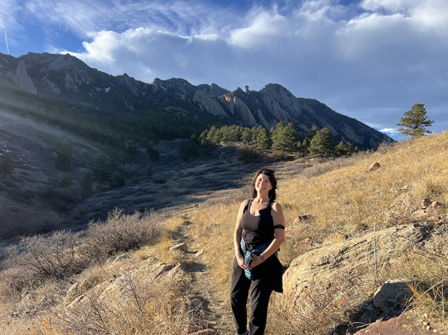
64) Chapman Drive, City of Boulder Open Space and Mountain Parks, Boulder, CO, December 30, 2024 - Our last hike of the year wasn't a big one but it shows we are ending the year healthy enough to still get out to enjoy the beautiful outdoors. Alan's broken ribs and Jonna's broken foot are both on the mend. We were going to hike down in Boulder but it was crazy windy so we drove a little ways back up the canyon to hike the Chapman Drive trail. It is protected from the wind by the foothills but still open enough to get some mid-day sun. We climbed halfway up Flagstaff mountain and were thankful to find the trail dry and clear. At the halfway point we turned back not wanting to stress Jonna's foot too much on our first hike in the three weeks since she injured it. Nothing fancy but we were glad to end the year with another hike. A 2.5 mile out-and-back with 550 feet of elevation gain.
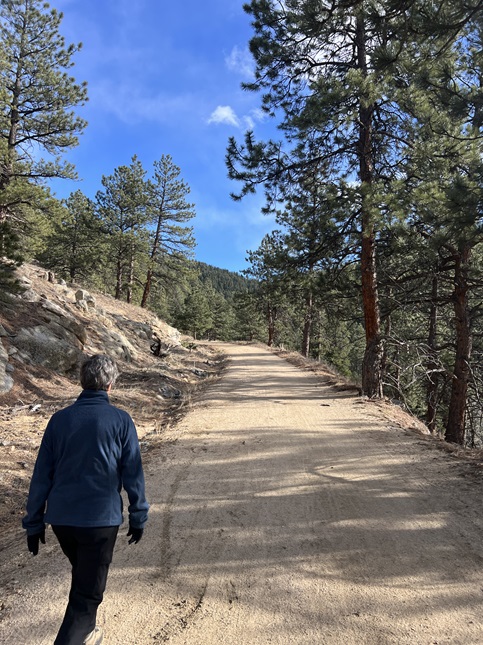
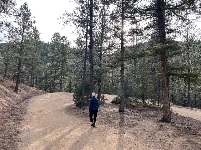
If you enjoyed these you may also enjoy checking out some photos from our 2023 hikes.
